Showing posts with label iron mountain. Show all posts

Thursday, July 14

East Fork Group Thru Hike - San Gabriel Mts


It's really simple. The East Fork of the San Gabriel River is gorgeous. From its birth in the high reaching pines, to it's chaparral covered terminus with the West Fork, Mother Nature has sculpted a truly unique place. Guarded by 8,000 foot peaks & miles of wilderness. Over time, as humans do, we were dawn to such a place. Originally this watershed was used for Native American hunting & early trade routes, though eventually relenting to extensive gold mining & western civilization. Now there is a mix of both days gone past & new generations using this gorgeous canyon as an escape from the Los Angeles megalopolis.


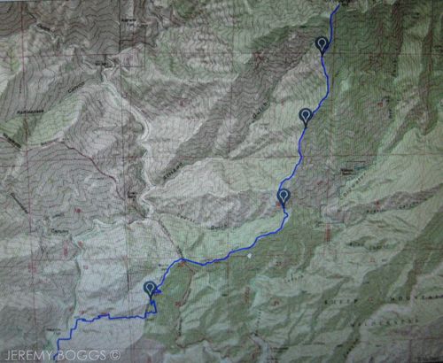
Many years ago, three other friends & completed this trip through the East Fork, from Vincent Gap (6,585ft), down Mine Gulch, past Fish Fork, past Iron Fork, through the Narrows, over the Bridge To Nowhere & out to Heaton Flat (2,000ft). Over the years everyone talked of it's beauty & how several other friends hadn't enjoyed some of the more remote sections. That is how we came to assemble enough people to fit into an airport shuttle & head off into the night on Friday one eve in Spring. 


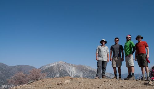
To complete the East Fork thru hike it requires a car shuttle with about two hours different people the two places. Not fun in the dawn hours of the morning, so we left two cars at Heaton Flat and hired a true shuttle to take all of us up to Vincent Gap. Piling out of the van a bit before midnight on Friday at higher elevation was a brisk wake up call. In the clouds & the rushing wind, we shouldered our packs, took an awesome group photo & all started out for our first camp of the night... Arizona fugitive, Tom Vincent's cabin.


Hammocks were strung, a tent or two were set up & a round of libations was enjoyed at the cabin, only about a fifteen minute walk from the parking lot, hidden nicely on Baden-Powell's eastern slopes. After killing two (three?) fellow gold miners in Arizona, alias Tom Vincent, made his home high in the San Gabriels for thirty years. He discovered what became the most lucrative gold mine, locally known as the Big Horn Mine. Our mission was more tame, get some sleep & meet three other people that would be joining our party Saturday morning, before we head into the East Fork proper.


Once we rallied everyone, we now totaled fourteen people strong! This was the biggest group I had ever backpacked with on such a demanding trip. It was sure to be memorable. We headed further down into Vincent Gulch, finding the mid century Cessna plane crash site closer to the bottom of the canyon. An interesting resting point. We ran into a large group of hikers cleaning the trail from bottom to top & were outstanding patrons for our local mountains. 


Getting some trail behind us now we crossed over the massive rock field that is at the bottom of Mine Gulch, the main feeder of gold into the East Fork (a favorite part of mine).


As the canyon twists and turns there is no trail now. Each person is free to choose their own path over the wide river bed. At times is is crucial to cross the river to travel much easier on the other side. Other moments the canyon floor is the size of a football field. Many of us are fond of gazing up to Iron Mountain's peak. A particularly difficult hike that most avid locals love to check off their list


Once we had reached the base of Iron Mountain the canyon tightens up a bit & there is a choice, to bushwack on the sides or go straight in the river & walk the easy wet path with now trees blocking. Everyone took their own approach. After some more time spent weaving in & out of the tightly beautiful Alder trees we came upon Fish Fork feeding into the East Fork. This is how you know you have come to one of the most wonderful & remote backcountry camps in all the San Gabriels, 8 or so miles from Vincent Gap. 


The usual camp chores began to happen, but on steroids. Sharing this small historical camp with fourteen people meant a party no matter what. As the sun faded behind the canyon walls each hiker took their bed time perch at various moments of the night. Light laughter was carried away with the embers snapping in the hundred year old fire pit.


The next day we all took to hiking in the water purely because it was much easier to avoid the dense trees on both sides. Each bend in the canyon revealed smooth, time sculpted walls of rock. I wondered how many Native Americans & gold miners have walked this same path. One of our friends knew how to find Iron Fork camp, so we opted for a side trip up the canyon mouth to relish a bit more San Gabriel history.


Continuing on we finally reach the Narrows of the East Fork. Though not a tight slot, the enormous canyon walls tower far overhead, while rolling rock & sand beckon us to explore. Pausing several times to take photos & truly just gawk. Each turn of the canyon reveals more tranquil beautiful  majesty.


With one sharp right turn the Bridge to Nowhere is insight. A backcountry monstrosity that has been abandoned long ago by a futile effort to build an escape route out of Los Angeles per a natural disaster. After a nice rest in the shade, we took a vote to take a different route home. Hopefully we would get to visit the Horseshoe Mine & search out a hidden unmarked water.


After some navigation & more off trail travel our amigo lead us right to the open tunnel for the Horseshoe Mine, leading deep into the Earth. Always an exciting time wandering through the dark with our headlamps, dreading to ever work in such a cramped space.


Down canyon a bit further we dropped our packs where a very small outlet feeder stream merged with the East Fork. Diving into the dense brush we found a very faint spur trail that led us to extremely odd cabin ruins built into the mountain side, then further to the base of one of the most awe-inspiring waterfalls I've been to in our local mountains.


Needless to say we all spent a ton of time shooting photos & crawling up the outer flanks of the falls to see what else could be discovered. Back down at the creek merger, our packs lay waiting. The last four miles wasn't going to hike itself... so we set off.


Through the immensely wide lower portions of the East Fork we dodge all over the place working on finding the best route. Eventually we crossed the proper Bridge To Nowhere trail (hugely popular!) & were on our way to the cars. 


Not with one last stop at another gold mine though. Near the forest service amenities, close to Heaton Flat, there is a very hidden path that leads about two hundred feet up to crumbling stone ruins & a very deep curving gold mine named after the owner, Billy Heaton.


After sufficiently deciding we'd seen all the local mountain history we could handle we hiked the last quarter mile to the cars wearing huge smiles & slapping high fives in the Heaton Flat parking lot... ready to explore a beer & extra large pizza.


Wednesday, April 10

Iron Mountain #1 - San Gabriel Mts

If you have not heard of Iron Mountain, set amidst the peaks of the Angeles National Forest, local historian & hiking legend, John Robinson sums it up well,

"8,007 foot Iron Mountain is by far the least accessible peak in the San Gabriels.... No trail approaches its isolated summit , & to climb it you must start miles away & thousands of feet below." In this local hiking legend's view, "Big Iron" is the most strenuous one-summit hike in the entire San Gabriel range." 

 photo IMG_0938_zps0376ba55.jpg

With those words in mind we arrived at East Fork (Bridge to Nowhere) trail head at 7:30am & set off amongst the 30 some odd people signing waivers to bungee jump San Gabriel hiking hot spot the Bridge to Nowhere. Taking the fire road north, we met the Heaton Flat trail junction quickly... & the uphill began. This hike is particularly infamous for climbing 2,000 feet to 8,007 ft, with a bit over 7,000 ft of elevation gain, b/c unfortunately this is a roller coaster of up & down disappointment.


 | Click to PLAY the video of our trip |

 photo IMG_0871_zpsb20d9562.jpg
| First good views of our goal, summit Iron Mt |

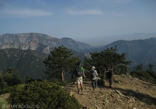
Ascending out of the East Fork under a great morning haze went smoothly, reaching the first saddle & making a hard left, beginning to get a good look at the ridge line we would be traversing. Keep in mind the whole first five miles (repeat on the way back) to Allison Saddle is just the set up for the real work. We spotted some others ahead, eventually meeting two people in their 70s attempting the summit!! The Korean husband said this would be his 23 of Big Iron.

 photo IMG_0882_zpsaa857464.jpg
| Kevin hiking Heaton Flat Trail. Follow the ridge line |

At this point we were about to tackle the last portion to Allison Saddle (this was labeled Coldwater Saddle on the Forest service sign I believe). Carlos, Kevin & I had been constantly looking over our shoulders back at the ridge b/c another good friend was running late & promised to catch up... famous last words heard on all seven continents I'm sure. We all agreed that this trail was a ball buster already & going solo would be a truly different hike.

 photo IMG_0880_zpsa65e27e5.jpg
| This isn't even the steep part yet. Carlos, thumbs up |

Our threesome dropped down to our first real break at Allison Saddle, 11am & with no chance now to use the binoculars to watch the ridge for Collin. Food & water is pulled out & not five minutes goes by & we hear a rustling from the trail behind us & a voice giving a hearty hello, Collin had made it!

 photo IMG_0884_zpse36a1726.jpg
| Are we getting any closer? Ridge line in foreground is the route |

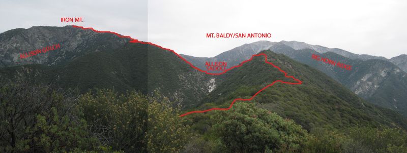
After many smiles & a good rest, some exploration of the faint Allison Mine trail, our troop of four was ready to begin the final two & a half miles to the summit. Here is the point of the story where all the words like steep, loose rock, arduous, miserable ascent, sheer beauty, & other curse words that we'll save for the mountain begin to emerge.

 photo IMG_0859_zps814d4603.jpg

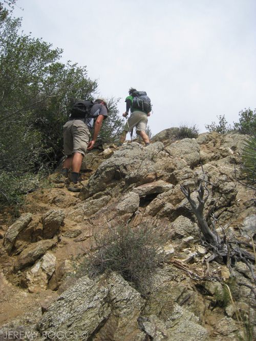
The ridge begins with the loosest possible dirt & mixed rock that continues for some time, since everyone is still in good spirits & laughing about how fun this crazy trail is seems to pass some-what quick. 

 photo SheepMt_Wilderness_Pano_TEXT_blog_zps2ac3ec72.jpg
| Iron Mt, Mt Baldy, West Baldy, Big Horn Ridge, Rough idea of roue |

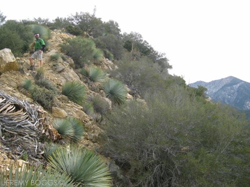
We eventually top out of the first steep climb to about ten feet of level trail & we begin to loose elevation that we just climbed. The whole time looking at the very next steep quarter mile of climbing we have to overcome. If I remember correctly at the top of this next portion there is a tuft of pines that beckons weary hikers.. only to have the trail skirt them at the upper section of this climb.

 photo IMG_0888_zpsd174879e.jpg
| 1 of 3 in the "STEEP" Photo Series: Collin & Carlos gaining serious elevation  |

By this time, the 5 liters of water & 2 liter of Gatorade are welcomed love & a cursed weight. There is no fresh water in route on this trip & will most likely require one and half meals. Our group had slowly been finding different paces up this beast of burden & growing closer to lunch time we had to pick a spot on this devilious trail. 

 photo DSC_0009_zps5649c581.jpg
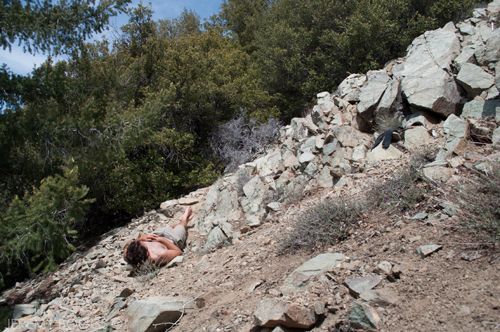
| Lunch time relax. Nice soft spot. |

It was 1pm & it had taken us a bit less than two hours to gain a bit more than a mile. Let that be a testament to this final ridge push. While eating lunch two different solo hikers passed us, one young woman was obliterating the a trail & had started at 10:30am. After picking our jaws up from the scree slope, we packed & moved on.

 photo IMG_0891_zpsa3d30f17.jpg

 photo IMG_0909_zpse685461f.jpg|

Lunch did not seem to provide the usual energy that it seemed to in the past, I guess that's Iron Mountain for ya. Our group hit a long stretch of ridge line after lunch that was really exposed & at the warmest part of the day. The aches & pains all seemed to be amplified with heat & sweat pouring over our faces. Keep walking, keep going.

 photo IMG_0892_zpsead6047d.jpg
| Final push towards the summit |

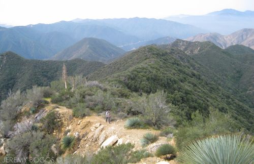
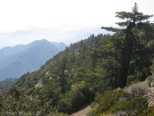
Finally reaching a point in the trail that began to have welcoming tree cover again & a breeze began to blow through the forest at this elevation. Iron Mt was truly living up to all its glory at this point, the surrounding views of the upper ridge were magnificent. Stopping often to catch my breath it was a marvel to look back down at the ridge we had first walk hours & hours ago, thousands & thousands of feet below in the East Fork.

 photo IMG_0914_zps55957d55.jpg
| Looking back towards our route |

During the final hour of this hike it had become more of a mental battle than anything else. Collin & Carlos had been able to continue through & were about 20 minutes ahead of Kevin & I. Thinking deeply (or resting some would say) at one point on a fallen tree, a gentle breeze touching the pines, looking east towards San Antonio Mt & Big Horn Ridge, a real calm came over the struggle I had been suffering from. 

 photo IMG_0932_zpse550c99b.jpg
| Mt. Baldy with the shadow of our Iron Ridge cast upon it |

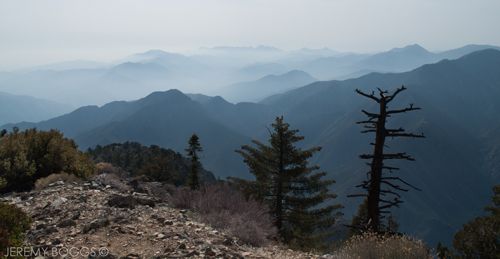
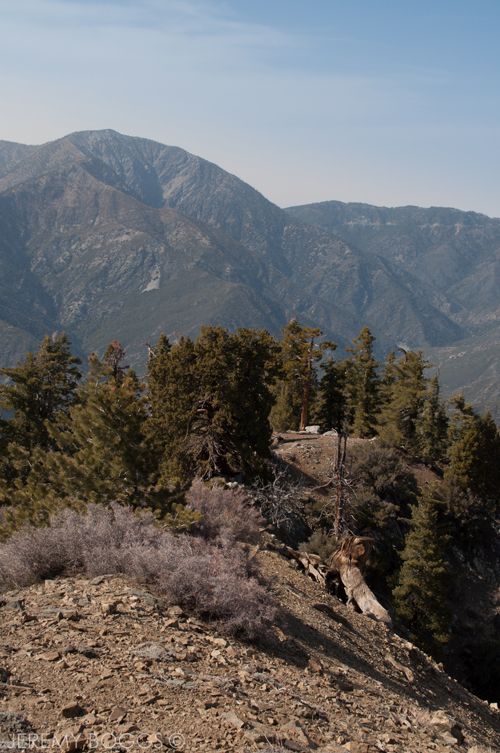
Climbing still higher, expansive views of several of the Angeles Forest highest peaks to the north west dotted the skyline, their steep craggy canyons converge into the East Fork thousands of feet below. The still quiet power of the San Gabriel back country is truly a magnificent escape from the thunderous cacophony that takes place in the city far below. 

 photo DSC_0023_zps9e03d4cf.jpg
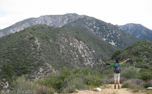
Tagging the summit at 4pm & drinking in the accomplishment. All around us rose the San Gabriels finest summits, hazed in the distance with a low cloud cover peaks poked through to only impress us more.

 photo DSC_0020_zps24c3a833.jpg
| Summit, Iron Mt - 8,007 |

More amazing views towards Baden-Powell in the photo below. Talk of an East Fork thru hike were in the air & going in search of Fish Fork Camp & of the Desert Divide Trail sometime before it's too hot. It really was a sight for sore eyes on top of Big Iron.

 photo DSC_0012_zps83acb83f.jpg
| Mt Baden-Powell in the distance 9,407ft  |

After a well deserved, shoes off, kick back in some meager shade time, 4:30pm was a definite hour to head back! After all we still had 7.5 miles of the same exact route we took to get here... & damned if it wasn't going to be a breakneck trip going down.

 photo DSC_0013_zpse38ae57d.jpg
| Notice the shadows are getting long? Getting later |

 photo DSC_0016_zps73b59c40.jpg
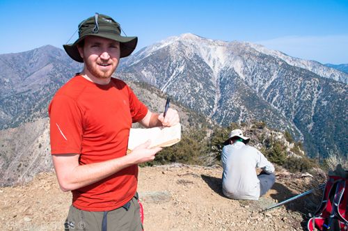
| Signing in to the summit register |

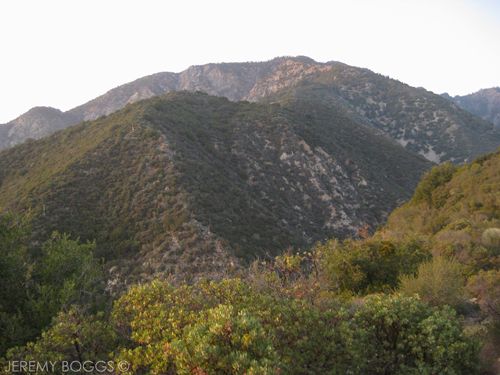
I personally enjoyed a great portion of this initial descent. Finally working different muscles & I was able to really become involved in the views around me more. The rock massif that makes up the Ontario Peak & Big Horn Mt area is stunning from the upper portion of this ridge (photo below).

 photo IMG_0915_zps59545ca2.jpg
| Bigh Horn, Ontario Peak & I think Lookout Mt in the background |

Moving as a well oiled machine now, anyone that wasn't leading, was eating dust from all the others loose trail dirt the whole way down. The short flat sections between the roller coaster style drops were speed zones that everyone hustled through to make up time as the sun began to get lower in the western sky.

 photo IMG_0933_zpsbf5d9877.jpg
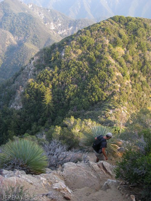
| 2 of 3 in the "STEEP" Photo Series: Collin below with a stunning view down the line |

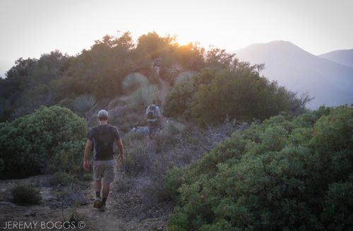
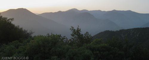
Climbing further down we finally reached Allison Saddle just before the "magic hour" began to set in. The views along the Heaton Flat Trail during dusk were fantastic, the mountains turning a faint purple & casting a long silhouette against the deep blue sky.

 photo IMG_0925_zpsbb7ef9b9.jpg
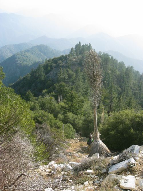
| 3 of 3 in the "STEEP" Photo Series: All three guys skidding down an open rock section. Lots of ridge line to still walk in the background |

 Reaching the last switchback leading to the saddle that drops into the East Fork the sun had said good bye & the remaining light held out for another 20 minutes of this down hill section. Making that sharp curve into the last portion of the East Fork was kind of a mystery. Our group had hiked it so quick at 8am that morning, in daylight, but it seemed to go on forever in the black of night.

 photo IMG_0942_zps491685a8.jpg
| Sun setting along the Heaton Flat Trail |

Dawning our headlamps we pushed through the last bit of trail, knowing well we had conquered the one of the hardest trails in the San Gabriel Mountains. Spilling out onto dirt fire road was an amazing feeling. Smiles slowly crept back to people's faces as we strolled down the flat road cursing the battle just fought.

 photo IMG_0941_zpsec1d2367.jpg
| San Gabriel Mountains |

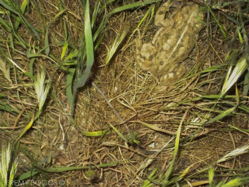
We didn't see any Big Horn Sheep along our journey, which the area is one of the last homes, however there were loads of birds along this trip, at all different elevations as well. This frog below, found us right at the bottom of the Heaton Flat Trail at the East Fork, what a lazy bum.

 photo IMG_0949_zps9019a1c8.jpg