
Just as many of our other adventures have started, the Tahoe Rim Trail was just an idea thrown out over some good beer at one time or another. Flash forward, leaving Los Angeles at 5:30pm north on the 14, we would eventually arrive at Mt. Rose campground just above Lake Tahoe a bit past 3am. Tomorrow would be the beginning of our 165 mile thru hike around the largest alpine lake in the United States.
(Roughly 14 Miles - September 1)
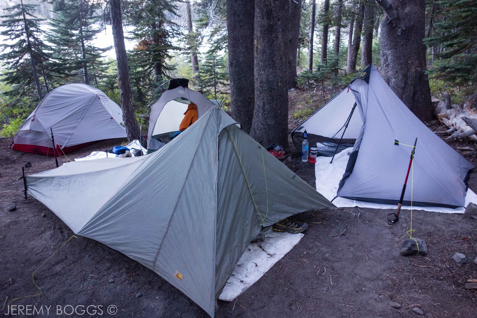
With no other cars and no other people at the Tahoe Meadows parking lot, four good friends set out on another long trail. Everyone's energy was high and the first views of the lake all afternoon helped tremendously to shrug off yesterdays long haul. Carrying the extra water for the dryer eastern sections didn't seem quite so bad yet. After lunch a curtain of trees rolled away to reveal Marlette Lake, perched high above it's massive brethren, Lake Tahoe. The winds had been blowing all day and that evening was no different at Marlette Campground. The massive hand pump well was quite outstanding & a welcome treat to drink from.
With no other cars and no other people at the Tahoe Meadows parking lot, four good friends set out on another long trail. Everyone's energy was high and the first views of the lake all afternoon helped tremendously to shrug off yesterdays long haul. Carrying the extra water for the dryer eastern sections didn't seem quite so bad yet. After lunch a curtain of trees rolled away to reveal Marlette Lake, perched high above it's massive brethren, Lake Tahoe. The winds had been blowing all day and that evening was no different at Marlette Campground. The massive hand pump well was quite outstanding & a welcome treat to drink from.

| Still smelling good - the beginning |

| Marlette Lake popping out |

| On the rim |

| The well at Marlette Camp |
(Roughly 17.5 Miles - September 2)
(Roughly 17.5 Miles - September 2)
Our second day was a lot of up and down across the eastern rim. The morning miles were like a dream, getting one last look at Marlette Lake from above, then cruising across high alpine meadows with views into tomorrows sections. Mid morning was consumed with downhill all the way to Spooner Lake. The pros outweigh the cons at this location, but not by much. We watched eagles fish & also got to tank up on mediocre water ourselves, not without a mud pedicure first (photo below). That afternoon we climbed towards South Camp Peak & some grand views along the rim of the mountains. We could see all of the trail & landscape we still had to hike. Coming across what is quite possibly the best bench I had ever sat on, we took an awkward group photo (below as well). That evening dry camping was planned so we just kept hiking till we found a bit of flat ground four guys could fit. That turned up just before sunset.

| Gossamer Gear Murmur on the TRT |


| High above Marlette Lake with Lake Tahoe in the back |

| Spooner Lake lunch |

| We really need the water |

| Water filtering pedicure |

| On the rim again |

| The odd colored shoes were on sale |

| Awkward group photo |


(Roughly 19 Miles - September 3)
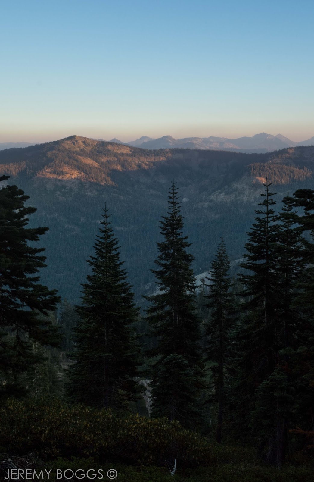
Day three dawned and we were on the move. The goal was to be efficient about miles and hiking so as to get to our camp at Star Lake with enough time to enjoy the surroundings... we'll see. Our one water cache we placed on our drive in at Kingsbury North was good to have, but over necessary. We met a few other TRT hikers that had cached water at many many places & other hikers that hadn't at all. Personally, after not hiking anywhere in Tahoe previously, we figured it couldn't hurt since we drove into town that way to cache once. Next was our hike up Heavenly Ski Resort & off towards our alpine basins that await. This section up to Monument Pass seemed to take much longer than it should have. The last few miles to the crest looking down onto Nevada farm land are one of a kind. Resting up, everyone crushed the last few miles from the pass to the lake at their own desired pace with the reward of the evenings alpine glow on the massive head wall above Star Lake. The wind was fiercest this night.

| Good morning |

| Mediocre Spooner Lake water |

| Getting closer to South Lake |

| Shade by the highway |

| Heading towards the furthest peak |


| Massive. 24 foot diameter tree! |

| Star Lake |

| Six Moon Designs Deschuetes Plus = WONDERFUL |
(Roughly 15 Miles - September 4)
(Roughly 15 Miles - September 4)
No one really "slept in" on the fourth day. The wind still blasted up the long canyon to our basin and made us all hike out of camp in our layers. We crossed a pass with a name that escapes me now while writing this (update: Armstrong Pass), but was followed by wondrous rolling granite mountains. Our trail weaved in and out of wide spread stunted pines. I pictured feet upon feet of snow up high here in the coming months, looking far down to the dark blue body of water. We were getting closer to the southern tip of the trail now. After passing through the overflowing parking lot at Big Meadow Trailhead, we hiked uphill on the overcrowded trail to the very well attended Round Lake. Alas, we had arrived on a long holiday weekend so we can't blame all these awesome people for wanting to get out. That evening we got separated from one of our hiking partners for a few hours, but cooler heads prevailed with no problems. The Tenkara Rod played on the water while the sun turned Round Lake a soft hue of pink.

| Heading to Armstrong Pass |

| Interesting trees |


| Ultralight |

| Hikertrash |

| The reason to hike right here. Big Meadows, Tahoe |
| Cramped camping on a holiday weekend. Round Lake |
(Roughly 13 Miles (town) - September 5)
(Roughly 13 Miles (town) - September 5)
We had fallen a bit shy of miles on the previous day so those were to be made up while hiking along the PCT towards South Lake Tahoe. The lure of food & town was enough to get moving at a decent time in the morning. Aspen grew tall along the trail more often in this portion of the mountains. Wide meadows lined with pine trees became more frequent, above us volcanic mountains billowed like white clouds on an endless day. Passing one of the few historical elements on the trail I took a side trip to the Meiss Ranch cabins. The climb after to Showers Lake was one of the only portions that felt like trail straight out of the my local San Gabriel Mountains. Finally, some steep trail that got to our destination quick. One last prolonged climb up a volcanic bench afforded far reaching views over land we had hiked the two previous days. Tucked away again in the forest we all set our legs in gear for the highway some seven miles away. Two of our compadres hitched rides within minutes into South Lake Tahoe. Myself & another were not so lucky. However, eventually we all had our shoes off, beer in hand, pizza in the other & music playing in our hostel. One night off the trail felt nice.


| Meiss Ranch & meadows |

| Showers Lake (PCT) |


| Camped dead center two days ago in the far distance |

| See the backpacker? |

| Jumbled up |

| South Lake Tahoe |

| Showers & relaxing |
(Roughly 15 Miles - September 6)
(Roughly 15 Miles - September 6)
Our ride dropped us off at Echo Chalet with the sun just cresting the horizon. It was crisp & we were all about to set out on the next large section of trail through the Desolation Wilderness. After several miles on well traveled forest paths we emerged on the far end of infamous Lake Aloha. Everyone wrote about this place and here I am too.Truly worth all the words that had come before me, an entire day would be needed to explore only half of the wonderful rock & water features of this immense sanctuary. Within a few minutes we were walking a rocky trail only twenty feet above yet another wide open alpine lake. An island lived in the middle here, adding picture perfect perspective to the high granite outcroppings. Pulling up for lunch before the climb to 9,400ft Dick's Pass, we all soaked our feet & relaxed in the sun at yet another perfect alpine lake.


| Echo Lake |

| Lake Aloha |


| Perfection |
The climb was steady & rewarding. With all our time gaining elevation, eyes were transfixed on the nature that was all around. Impossible peaks gave way to pine covered basins of rock and water. Finally reaching Dicks Pass, our spirits were lifted by the expanse of wilderness that lay out before us. The bluest lakes dotted the rocky mountains in all directions. Dicks Lake became our camp for our first night in the Desolation Wilderness.

| Climbing to Dicks Pass |


| Dicks Pass - 9,400ft |

| Desolation Wilderness |


| Can't speak highly enough about Six Moon Designs, Katabatic Quilts & Gossamer Gear equipment for backcountry travel |
(Roughly 22.5 Miles - September 7)
(Roughly 22.5 Miles - September 7)
The seventh morning came with a change in pace for one of our fellow travelers. A foot & tendon pain had brought rough times, but had for many days previously not curtailed the huge laughs & great times we all shared. A massive undertaking that I admire immensely. North Lake Tahoe was everyone's goal, just at different arrival dates now. Three of us now headed into the calm early morning. Every turn the mountains awoke with the sun, life creeping into the blue shades of granite corners. After a few miles we realized we had not filled up our water before a nine mile dry stretch & that gave a nice thing to focus on while walking in the forest. Eventually popping out to Richardson Lake, a shallow muddy lake that looks much better than I just described (photo below). With lunch done we were on the move with the intention of camping at a creek we knew to have water. After several hours of great hiking in the woods & along volcanic outcroppings, we managed to pass our intended camp destination. The trail was now switchbacking up onto a wind exposed ridge at sunset. Which was both painfully gorgeous and not intended to be camped upon. Pressing passed twenty miles for the day we crossed onto the the backside of the ridge, deep purple mountains setting to rest all around. Just as night took us over on the trail we crossed friends from earlier days on the TRT, a small birthday toast went around & a makeshift camp was set up by headlamps on a protected pine ridge, looking into tomorrow's valley.


| Desolation Wilderness gold! |

| Middle Velma Lake |


| Richardson Lake |


| Barker Pass |


| Near Blackwood Creek |

| Edge of Granite Chief Wilderness |
| Desolation Wilderness Sunset |

(Roughly 14 Miles (town) - September 8)
The previous day would become our longest day on the trail. I had never backpacked more than twenty two miles before. I had also never woken up with so little to drink at a dry camp on a ridge after backpacking that far. We took stock of our H2O and headed off down into the valley below, just waiting for the moment the trail came close enough to the river. After breakfast our water problems were solved and we blasted through the dirt road walk up to Page Meadows. The last few miles to Tahoe City were done. The local brewery seemed fitting before picking up our resupply necessities. The sun was low in the sky, but we managed to walk out of town and get back on the trail without falling prey to another night in civilized luxury. After a few miles passed under our belt we called it a night on a volcanic rim looking down on the Truckee River. A thick under story of pine made for a comfortable bedding that eve.

| Dry camp, good view |


| Road to Tahoe City, before the Truckee River |

| Sent General Delivery to ourselves. Food all safe and waiting at local post office. |


| Truckee River far below |

| Six Moon Designs & Gossamer Gear going strong |
(Roughly 17 Miles - September 9)
(Roughly 17 Miles - September 9)
Our ninth morning getting on the trail was an old routine. However, these early hours held small chatter about putting in enough distance to finish in a ten day window, originally looking at eleven full days of hiking. We were certainly within reason of doing so and the challenge excited us. Today began with more uphill, which would be the standard until almost the very end of the trail the next evening. Through dense forest & well graded trail our trio eventually stopped at the shores of Watson Lake. The yellow jackets were everyone & a quick lunch was had. Filling up with lots of water we had one more dry camp planned for the trip. Passing a hard working young forest crew & a few small water caches that trail angels had maintained, we stumbled onto our second to last highway crossing. Some day hikers were finishing up at this time and thought we were insane for heading up to camp on the trail they just came down. It was about 6pm and we shrugged it off with the thought that we had found somewhere to sleep every other night. Without fail, wonderful flat pine covered ground was abound within three miles hiking, our last night on the TRT was coming to a close

| A picture perfect reason to be out hiking. Nature all around. |

| Watson Lake filtering |


| Towards the rim |

| DIY cooking pouch. Needs a 2.0 version |


| Last night on the trail |
(Roughly 18 Miles - September 10 )
Good morning from the last morning. Creeping
slowly uphill all day towards 10,338ft Replay Peak was a wonderful
crowing finish to our loop of Lake Tahoe. Miles slowly melted away in
the Mt. Rose wilderness as mule ear meadows carpeted our path heading
above nine thousand feet. Previous weeks of travel could be seen with
every step along the slim dirt path. Dropping now mildly to Grey Lake
was one of the more exceptional last minute surprises we treated ourselves to. An outlet stream fed by a reed covered
body of spring fed mountain run off was a welcome last respite before
our final push to the high point of our entire journey. Climbing well
graded switchbacks (in hindsight), we gained the final summit of Relay
Peak & breathing deeply of the moment with great smiles. Throwing our packs on for the last time this hike, we started to descent off the ten thousand foot peak towards a small pond far below us. Passing now into the forest be posed for a last smelly group shot at a local classic day hike waterfall. The few tourists there laughed at our misfortune of taking our entire vacation walking in the mountains and sleeping on the ground. The sun was setting low now well into Fall, golden yellow views stretched for a hundred miles as the eye could see. A final pull of whiskey was shared over the last views of the deepest lake in the United States. A journey well done by all.

| Simple life |


| Desolation Wilderness in the distance |


| Marvelous hiking |

| Grey Lake |


| This little guy hiked/rode the entire TRT |

| Closing in on Relay Peak |


| Four miles till the end |


| Very smelly group photo |

| One mile left |


| No hotels were open so we drove back to where we finished and slept on the ground. Very fitting. |