

| Best photo to show how steep the climb is. Three people in the background |
"There is more than one way to skin a cat." That old phrase comes to mind when thinking of Strawberry Peak. With three different trailheads that will bring you to the tallest San Gabriel front country peak, a day hiker has many options. The most heavily used path is from Red Box parking lot, an often less used start near Colby Ranch, but the third is just right... an indiscriminate turn out along Angeles Crest Hwy.

| Spring with Strawberry Peak in background center |

We opted to leave a car at Red Box both times we've done this hike & then drive back to the trailhead with a secondary car. On an early spring day just after a rain we were treated to a nice waterfall right at the beginning of the trail. After a few more minutes climbing up Colby Canyon we crossed the top of another nice waterfall plunging down into Colby.

In the upper chaparral, the trail climbs steadily, but never very seriously. One of the things I like is that you are almost always looking at the peak most of the hike up. Gaining much more elevation than the Red Box approach.

| After the saddle, first climb at the white-ish rocks on left |
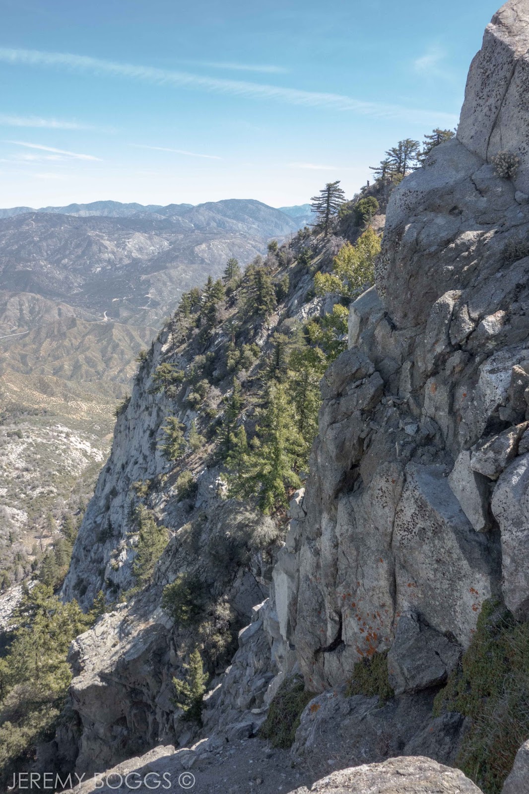
Reaching the saddle between Josephine Peak & Strawberry Peak is a nice resting spot. There isn't much shade on this hike, but you can find some under the water catch basin on the saddle. From here you can see a nicely groomed trail that leads around to Strawberry Meadow, a use trail cuts off this almost immediately to follow the ridge up towards a white-ish outcropping of rocks. The trail is easy to follow once on it.


At the base of the rocks is the first climbing section. I tend to follow it to the left & up, looking for the white sand/small rocks that are an easy steep walk up after climbing several moves. If this was easy, the final climb will be fun & thrilling. If this small portion was way too intense, maybe rethink the last climb up to Strawberry.

| Sandy gully to top |

The trail weaves nicely up to finally reveal wider reaching views into Upper Big Tujunga. The remains of the Station Fire are so apparent when on this peak. In all directions we can see the burn area, along with the growing amount of Poodle Dog brush that increases at the elevation goes up that populates after wildfires. Serious skin irritation can occur when coming into contact with the plant.

| The boulders begin |


| Boulder fields leading to the climb in back |

Eventually the trail turns to the large boulders that lead to the bottom of the climb. The large talus is easy going & there are cairns if you need them. It seems to be fairly obvious where you need to be heading towards.

| Beginning of climbing |


Each time we did this hike, we started the climb a different way. The first time, we went up the first little zig zag trails to a small climb. Then noticed the second time, you can go under some Poodle Dog bush & take a more steep hike approach that will take you to the same place.

| Straight up at times |

| Careful & steady. Several moments like this |

From here we followed what appeared to be the path that others had taken. Looking for the crushed rocks/sand where a path had formed at times. There are a few old faded red rags that are classic markers. In all reality this is hand or fist climbing with a few moments where serious consequence will result terribly. With confidence & safety there should be no problem for a group to look out for one another on this route.

| More careful moments |

In the upper sections there are a few white painted arrows that can lend a hand if need be. For the most part with a careful eye a skilled hike can notice the best path to go. Once more pine trees come into view you know you are closer to the final climb.


| The ridge we climbed with Josephine Peak in back |

| Break on the climb |
After cresting some of the last boulders, it's an easy minute stroll up to the top... 6,165 feet up. This summit never disappoints, great views all the way to Catalina Island, downtown LA & on to Mt. Baldy.
We parked a car at Red Box so we took the standard trail back
which is always scenic & a nice way to wind down from the thrill of
accomplishing the climbing on the other side of the mountain.

| Bigger boulders, closer to the top |


| Summit |