
Setting up a car shuttle for a backpacking trip means two things, it guarantees whatever trip has been planned is of good quality & it is going to make everyone so damn anxious to hike from all the driving it is incredible.
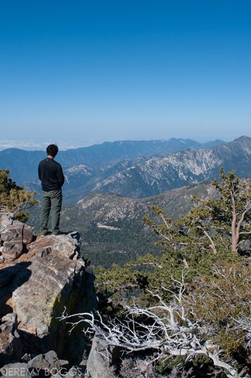
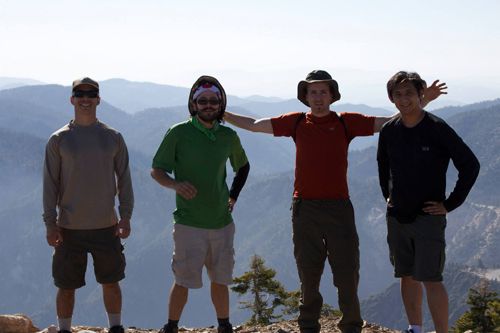
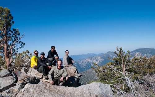
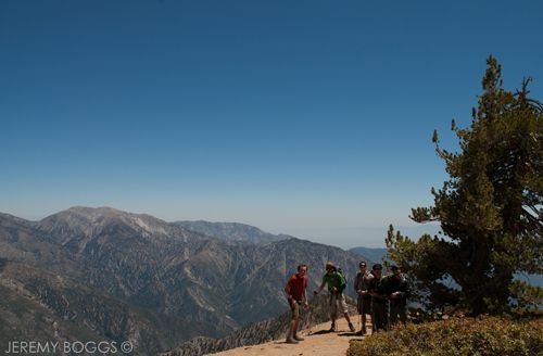
| Standing on top of Middle Hawkins Peak, looking into Crystal Lake Basin |
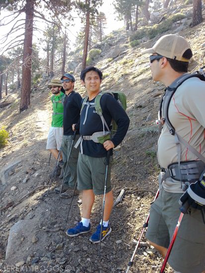
Carlos & I were real lucky to have three new people from San Diego to spend the weekend with us on a new adventure in San Gabriels. Our plan was to head out from Islip Saddle & tag six different mountain peaks before ending the next afternoon at Vincent Gap, a small south bound portion of the PCT.
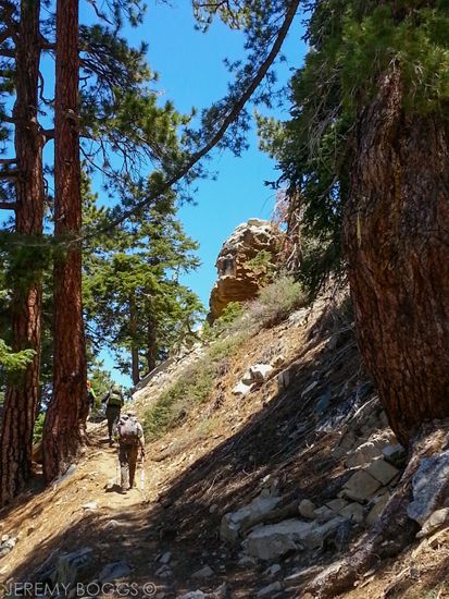
| Day 1, heading towards Little Jimmy Camp & Mt. Islip |
After all the mountain driving we were walking the usual 2 miles to Little Jimmy Camp, always gets people breathing quickly on those few switchbacks away from the highway, soon to be tucked away in the forest on the north flank of Mt. Islip.
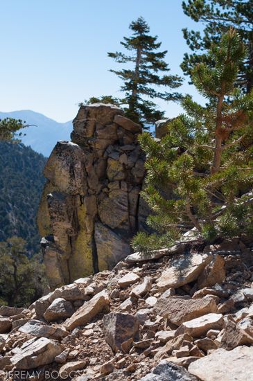
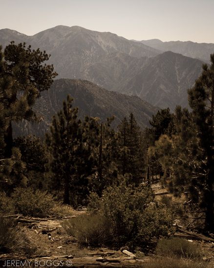
| Admiring views into Crystal Lake Basin, heading towards Mt. Islip |
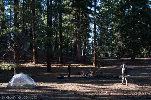
Within a short time we had wished a few thur-hikers a good journey on the PCT & pulled off to Little Jimmy Camp. I could say this camp is a local favorite, but when you show up & there are literally 35 to 40 tents (think two people per tent!) littering the possible acre of land that the camp encompasses it is more of a so cal hot spot! This would be our 5th trip to the camp and only one other time there wasn't two or more boy scout troops. This must have been five or more different troupes.
| CLICK PLAY TO VIEW THE VIDEO |
Hightailing it for the upper reaches of the camp, the five of us found a small basin that blocked all the sound from the circus below, but lay only 25 ft from the nearest scouts. One of those moments when Mother Nature works out just right. After filtering some water & setting up camp, we were off the grab our first summit. The hike up to Islip was really nice, once around a couple bends in the trail the views open up into Crystal Lake Basin & on to Middle & Sadie Hawkins Peaks.
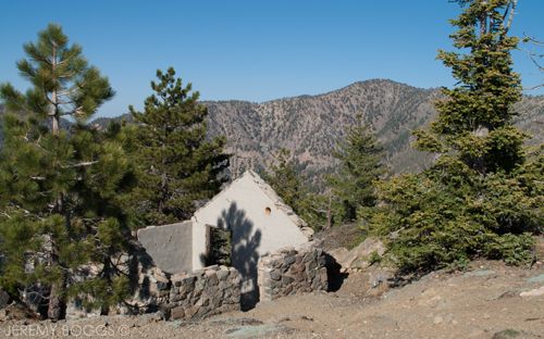
| Historical remnants on Mt. Islip & one of tomorrow peaks in background |
| Peak 1 - Mt. Islip 8,251ft |
| Peak 1 - Mt. Islip 8,251ft |
Day hikes had brought me to many of these summits, but this overnight trip was a chance to link them all together. This was the first time in the Gabriels for two of our friends, so they were amazed to say the least at the views of the surrounding mountains. The old hut was an added bonus for the experience. I enjoyed the expanse east, observing our goals for the next day.
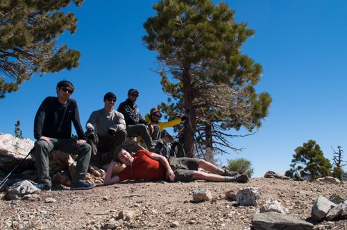
Back down at camp the plethora of mixed dinners started to reveal itself & all methods ensued. I enjoy one night trips for many reasons, but experimenting with food & different cook styles is always a good time.
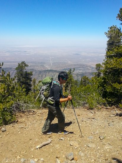
| Day 2, Getting leg work in off trail |
A lot of the motivation for this trip came from the fact that I hadn't seen a couple of these guys in several years, but we had grown up together in the San Diego area. The time we spent sitting around that eve, laughing about everything under the stars, was really the experience I was looking forward to.
Through the night the wind had picked up & was pulling & pushing at all the pines overhead. Waking early we all set about getting packed & walking. We had something like 11 miles to cover & five more summits to stand atop.
I wish I had the poetic penmanship of Muir or the legendary hiking tongue on William Thrall, but I will attempt to describe the invigorating zealous that Mother Nature was bestowing upon our humble walking group. What I could only imagine starting as a slow creeping breeze, barley able to move the hot Mojave sand it blew over thousands of feet below, was now a salubrious torrent of blasting wind that made us sway & waiver on the rocky trail. I don't feel that everyone enjoyed the experience as much as me, but those first few hours of hiking will forever be etched in my mind.
| Peak 2 - Middle Hawkins Peak 8,505ft |
Dropping our packs behind a large fallen tree, we all snagged some water, our cameras & we headed south along Copper Ridge for Middle Hawkins Peak. Not labeled on all maps, but it's one over 8,000ft that we need to stand on.. those were my first thoughts, but the views from this peak were truly unique. The rock formations along the upper ridge like are real interesting with great places to sit on the summit, looking our towards Mt. Islip from the day before on one side & Mt. Hawkins on the other, our next goal.
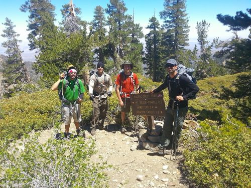
| Peak 3 - Mt. Hawkins 8,850ft |
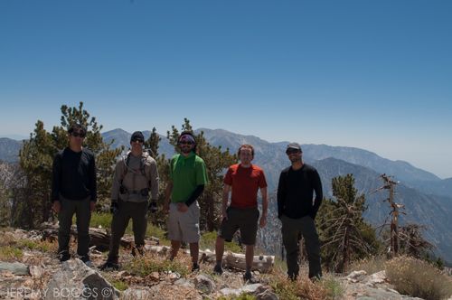
Before dawning our packs we chatted with another PCT hiker, she was on day 26 and was aiming to take care of the San Gabriel section in four days. Nice! Climbing now to Mt. Hawkins was the days first real work it seemed. A bit steeper trail & then a longer spur trail to the actual summit. Once again, another group photo & three peaks down. Later I would claim this as my favorite summit of the trip, but in reality while writing this, it was Middle Hawkins.
| Peak 4 - Throop Peak 9,137ft |
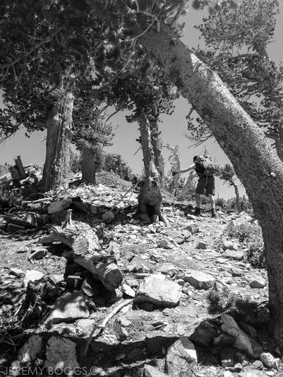
The next peak on the list could have possibly been achieved a bit easier with some further research. The natural trail to the summit of Throop Peak takes you past the peak only to switchback uphill at a junction the same direction you came from. Lots of plants covered this particular mountain, so there may or may not be a way to climb it's western slope from the PCT. It could have saved some time or could have been a futile effort (for another time).
| Mt. Baldy, West Baldy, , Iron Moutain #1, Cucamonga Wilderness peaks in the background |
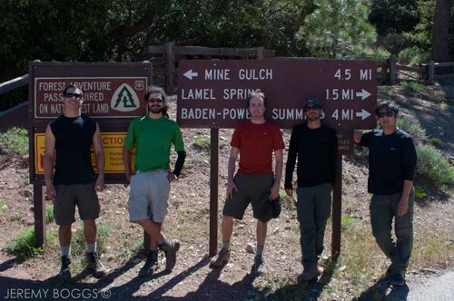
| Throop Peak one way, PCT another, Dawson Saddle the other, Baden-Powell our way |
| Throop Peak one way, PCT another, Dawson Saddle the other, Baden-Powell our way |
Scarfing down various lunch meals from our perch on Throop, we could see our final two summits off in the east, Mt. Burnham & Mt. Baden-Powell. All five of us felt renewed after lunch & ready to tackle the heavy elevation loss, before gaining it all back heading straight up Mt. Burnham off trail. My morning's love affair with the hollowing wind had faded, now a benign breeze accompanied the strengthening mid day sun.
| Desert thousands of feet below |
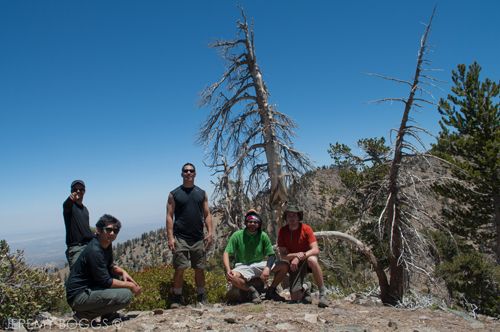
Flashing another group photo on top of Mt. Burnham we spent the least amount of time here, our final & sixth summit was within reach & everyone still had smiles. Let's keep walking. Straight up the spur trail on the ridge of Baden-Powell, everyone walked slowly to their own victory at the top. Carlos & Dave plopped down on the monument while others walked off in search of views into the East Fork. We had made it to our final summit.
| Peak 5 - Mt. Burnham 8,997ft |
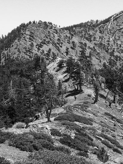
| Our group heading towards Mt. Baden Powell. Look closely, below center for people |
The patient switchback journey down Baden-Powell was a bit of torture after having so many trails just go one direction on this trip, either up or down. Now back to the anxious car shuttle business, everyone wants a burger & beer at this point, but we have to go get the other dang car. More patience back in the modern world.
| Peak 6 - Mt. Baden-Powell 9,399ft |
All in all, it was fun to wander the San Gabriels & have some old friends create new memories amongst our local gem.
2 comments:
Do you have a gps route for this? would love to see it
Hey Brandon,
I do have this mapped out at the link below. It's not from a GPS we took, it was more or less an outline to share when planning. Thanks for reading!
http://is.gd/bEswuL
Post a Comment