Showing posts with label lake. Show all posts

Sunday, September 1

Chicken Spring Lake Backpacking - Eastern Sierra Mts

The mighty Range of Light is a testament of challenging wonders that will reveal itself to those that choose to walk it's paths, deep into it's heart, while exploring their own.


Stephanie & I spontaneously decided to go for a weekend backpacking trip, but skipped the usual local San Gabes & went straight for the big stuff, Eastern Sierra's. Deciding originally on a loop trip, up over Cottonwood Pass to Lower Soldier Lake, then back over New Army Pass & through the Cottonwood Lakes region...... Mother Nature had other intentions.


Driving to Lone Pine, it was raining. We got dinner & our hotel, it was raining. We woke, snagged permits & ate breakfast, it was still raining. Feeling confident, we drove up to the trail head, maybe it'd look different at 10,000ft? After navigating the fifteen some odd rock slides on the road we made it to our parking spot, turned the Jeep off... it was still raining. 

| Near Cottonwood Pass, looking into Horseshoe Meadow |

All gear packed accordingly, about to set foot on the trail & the rain stopped, we couldn't believe it. Walking with smiles only lasted about thirty five minutes, the rain returned while we were climbing the switchbacks to Cottonwood Pass. The views down both sides were beautiful, cloaked in thick dark clouds all around us. 


| Chicken Spring Lake - Elevation 11,242ft |

Moving on now, we had spent some time in the rain & still felt good about it. Crossing into the 11,000ft range of elevation we started to encounter hail more than rain. The situation was changing rapidly. We were getting closer to Chicken Spring Lake, so we opted for an afternoon break there. 


The rock basin was stunning upon arrival, the hail continuing to grow stronger, covering the forest floor with a thin layer of white. That's when the thunder began. Rolling heavy & loud all throughout the mountains around us. What a magnificent display. 


By now we had decided to alter our route & call this lake home for the night. When the storm waned a bit, we put up the tent & unpacked gear, all still dry as a bone, things were looking up. Steph knocked out while I sat & giddly listening to every thunder clap for several hours. Lighting never showed up to the party fortunately, just lots of earth shaking noise. Props to Big Agnes, superior ultra light tents, this is the fourth trip with multi-hour storms with no problems what so ever.

| Inyo National Forest |

After showing off her power, Mother Nature decided to show us her softer side & opened up the skies for a majestic sunset that will live with me for a long time. Walking the shoreline & then finding a nice high point to see the last rays of light fall over these granite peaks was all the reassurance I needed that this is where we belong.


Retreating to make a tortellini dinner & snack furiously before sleep was all that had to be done now. Life was good, the stars were out & displaying all their allure. The next morning we still had some clear skies so plans were made to explore more before packing up.


| Chicken Spring Lake, Big Whitney Meadow |

Heading up the boulder section on the eastern side of the lake, we gained a ridgline that looked far down into Big Whitney Meadow. A most expansive & encompassing view. The rocks were interesting & warn along the top of the ridge from wind constantly eroding them away over time. Clouds slowly began to gather & we knew it was time to get walking. 
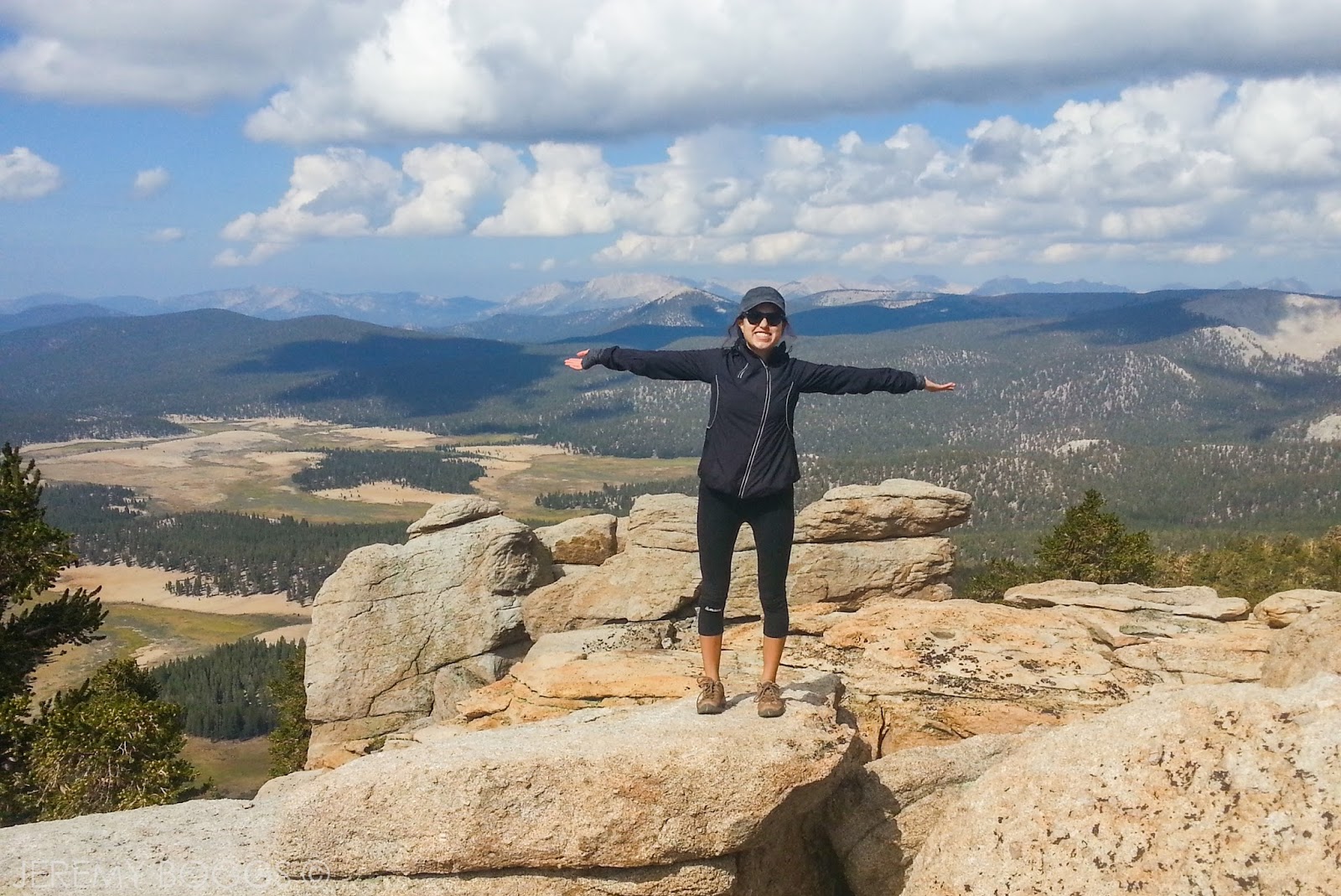


Gear was secured & slung over our shoulders, made it back to Cottonwood Pass with easy, but we could hear thunder & see the rain in the distance, right where we needed to go. Only about five minutes passed & were we in the thick of a shower & thunder roared again. However, today was different, for every 5 or 6 thunder claps we heard, a bolt of lighting would streak across the sky.


The lower section of the trail through the Horseshoe Meadow area is a mix of dense trees & large open & exposed trail sections. While Steph & I walked one of these open/exposed trail sections a bolt a lighting crashed down from the sky & struck the group in front of us in the same open area we were walking through! The sound was so incredibly loud we both jumped out of shear fright, leaving our skin on the trail behind us. Never had I seen or experienced anything like that in my whole life. Needless to say, hearts racing, we picked up the pace & made it to the car as more hail began to fall from the sky.

| Horseshoe Meadow |

The adventure didn't stop there, while driving out we experience a lighting strike, arc hundreds of feet tall, over our car, hitting the ground on both sides of Luken Canyon Road. Later on the Hwy 395, traffic came to a grinding halt due to a large flash flood mud slide that covered to highway (see video). Everyone stood around on the highway cursing obscenities... I was just thinking about the next trip to the High Sierra's.


Tuesday, June 25

Iva Bell Hot Springs 5 Day Backpacking - Eastern High Sierra's

| CLICK ANY PHOTO TO ENLARGE |
It was 2am & it was blustery in Mammoth Lakes. The guy at the front desk of our cheap motel seemed  to want company, taking extra long. Suddenly the morning alarms were ringing, permits were acquired & breakfast was had.

| Collin heading towards Duck Pass |

Second checking all items included, Collin, Carlos & I made sure between the three of us we would have what we needed make it through the next five days & 35+ miles of High Sierra backcountry.


Leaving Duck Pass Trailhead was an easy climb past several smaller lakes & catching glimpses of the pass we would be climbing. After saying Hello to a few day hikers & others angling in the creeks abound, we eventually popping out at Barney Lake for a rest & a chance to marvel at where only 3 miles of trail can take you.

 
 | Duck Lake & two travelers |

We had been eyeing Duck Pass (elv 10,814ft) from the lake below & could see some significant snow fields, but nothing that would obstruct our way. Climbing now higher above the rocky basin we were getting our first grand views & a small taste of what lay ahead.

| The Silver Divide |

Crossing a few snow sections & a steady uphill climb to Duck Pass rewarded us three with our first "accomplishment" of the trip... & hours ahead of what we planned? It wasn't even lunch time & we were over Duck Pass. Decision making time, being ahead of schedule should we press on, or just saunter to Pika Lake & relax all day?

| Off trail towards Ram Lakes |

We waved goodbye to the last person we would see for a couple days at the pass & voted to keep on to Ram Lake, skipping the first nights destination. Moving on now, the trail shows you a stunningly power waterfall connected to the Duck Lake outlet, then skirting the ridge, the trail overflowed with water from all areas of the mountain. It was hiker heaven...

| Ram Lake Sunset |

Moving west now high above Cascade Valley the vistas of the Silver Divide were incredible! I was really in love with our first day of hiking. For about a mile the trail is perched a thousand feet above the valley, allowing hearty travelers views of the snow capped peaks in all directions & rambling Fish Creek far below.
| Ram Lake Sunset |

 | Ram Lake Morning |

I had begun to fall behind due to my photography addiction/problem, but also a week or so before this trip I had nursed a sore knee back to health, that was already beginning to come back & give me a bit of agitation... more on that front later. 

| Ram Lake Basin |

Now at the junction for Ram Lake & the PCT/JMT, he headed off around the edge of Purple Lake towards the upper granite basin. I knew from last years trip to the Sierra's, this was going to be more work than it looks from afar (didn't hike this trail, just similar). Somewhere around a mile & a half (past Purple Lake) the Ram Lakes trail becomes discernibly harder to follow.

| Smooth granite |

After some time & a few creek crossings we followed a use trail & had a grand ol' time going the wrong direction that many previous travelers obviously had done as well, but still allowing us passage to Ram Lakes (elv. 10,800ft).

| Fish Creek Trail into Cascade Valley |

The magnitude of vast open spaces was really felt at this lake side. As the evening progressed the stars show brightly & our efforts were rewarded for a hard first days work.
| Near junction for Minnow Creek Trail |

The next morning we saddled up & headed back down the the basin to meet Purple Lake. Stopping alongside, granite spires rose high above the lakes edge, enticing Collin to jump in & take a swim. Crossing another junction onto the Fish Creek Trail now, we dropped down into Cascade Valley. 

| One of many waterfalls in Cascade Valley (hence name) |

It takes some time to get down the long switchbacks, but the second half is much more enjoyable with views out to the Silver Divide. Landing at the bottom, we stopped for lunch along Fish creek in the middle of a green grassy meadow. Gazing up at the granite shelf we had been walking on the previous day high above.

| Night 2 Sunset |

The morning's downhill stretch had worn on my knee a bit more, so my dear friends were kind enough to opted to pass on the Minnow Creek Trail/Lost Keys Lakes & stay steady down Cascade Valley towards Second Crossing. 

| Morning's water filtering in Fish Creek |

This afternoon's section was a nice walk downhill playing hide & seek with Fish Creek & it's five or six LARGE cascading waterfalls. A roaring amongst the trees was always a welcome sign. Though many sites/books had said to be weary of Second Crossing being difficult in early season, there are two large trees fallen across that make an easy bridge. 

| Saddle: Left side is Cascade Valley (where we came from), right is Iva Bell Hot Springs & Fish Valley for the next two days travel |

Our third day was set up for an easy morning hike right into Iva Bell Hot Springs. This also turned up some of my favorite views on the trip. The saddle between Cascade Valley & Fish Valley was a really unique place. Looking along Sharktooth Ridge & down onto the grassy slopes that make up Iva Bell Hot Springs.

| Iva Bell Meadows are full of life |

The next mile & a half of trail took a page out of the local LA mountain handbook... hot, manzanita, open slopes, period. Still the views towards Devils Top & the waterfall pouring out of the Lost Keys area kept me beaming with natural joy no matter how my knee ached.

| Iva Bell Hot Springs (upper) |

The afternoon sun was a bit warm for hot springs upon arrival so time was spent resting, cleaning clothes & organizing the downsizing of packs. As the sun dipped lower we made our way up several hundred feet up the steep grassy & granite slopes to several pools of rock fed, hot natural spring water. Sitting quietly, the birds called softly while the sun set behind the days accomplishments.

 | View of Devils Top from the upper hot springs |

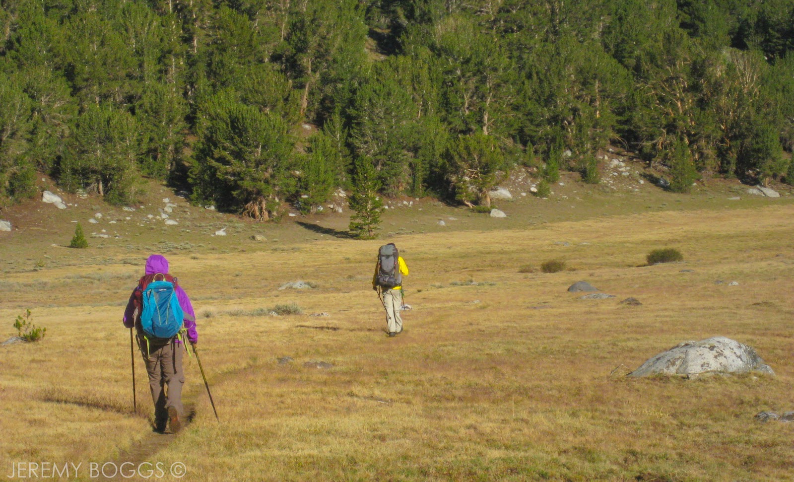
 From this night onward, the tent was only dead weight, the weather was nice enough each eve to sleep out under the stars. Smashing now down Fish Valley on day four, we all were moving at our own paces. The trail life had set in a bit more. Having wrapped my knee & ankle in a make-shift ace bandage (see video), I tailed behind the group, enjoying the solitude my disposition had given me.

| Milky Way |

The switchback climb out of Fish Valley, after Island Crossing, onto the bluffs high above is dramatically beautiful, but this is due to the exposure & lack of shade in the mid-afternoon. You get so sweat & have jaw dropping views. Working harder now than at Duck Pass, the apex of the climb seemed to be elusive.

| Day Four: Heading down Fish Valley |

I should have know better, for such a climb we were rewarded with endless meadows of wildflowers, grand views for miles towards Lion Point & beyond. To top this day off, we hiked across a massive granite face, with the trail chipped into the aged hard surface.

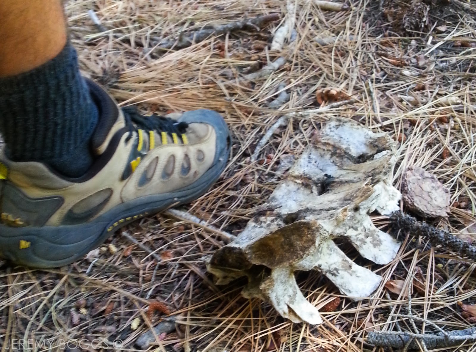
| Large bones near Island Crossing |

Stopping the last night a Crater Canyon Camp, we set ourselves up for a some-what easier hike out in the morning. One last night under the stars, with a morning of frost on the sleeping bag. A couple of meal bars later & we were banging out the last miles of the trail with Devil's Postpile in the distance.

| Upper shelf along the exit of Fish Valley, looking into Middle Fork San Jaquin |

Not necessarily on purpose, but we managed to take the long route to get to the Postpile, though beautiful nonetheless, we arrived excited we made it this far. Snapping some photos & chatting with people from Bristol (UK) we walked off in search of the highway, another mile or so away.

 | Collin walking a stunning section of trail! |

| Looking east towards Devil's Postpile |

Did I mention we had no way to get back to our car, 30 some odd miles on the other side of Mammoth Mountain? The three of us decided at the beginning of the trip we would only worry about the hitch-hike when it come to it.. so here we were at Reds Meadows awaiting some luck. 

 | Near our Crater Canyon |

| Views on Day 5 hiking to Devil's Postpile |

Sprinkle some trail magic & the second truck to came along has Norm behind the wheel & 2 PCTers inside. He offers us the back bed of his truck & a ride all the way back to our car! Check that box off the life list. forty minutes later we are dropped back at the car we left five days before. Many thank yous & well wishes were exchange.

 
 | Devil's Postpile Monument |


It was on to Mammoth Brewery for a cold drink & a gentle welcome back to society. The funny downside to the rest of the journey was the fact that we had gone five days without music, then the stereo in the car doesn't work the entire five hour drive home to LA... really a null issue at that point though.


 | Hitched a ride back to our car |


Thursday, August 9

Dorothy & Tamarack Lakes - Sierra Nevada Backpacking


When checking NOAA & noticing a 20% chance of scattered rain over the Sierra Neveda mountains, it's not out of the ordinary. Some 300 miles drive from LA later, standing in the White Mountain Ranger Station (no where near a mountain), new Ranger friend John is telling us a definite 40% chance on day 2 of our trip. We'd committed & no one hesitated walking back out into the 106 degree Bishop Valley heat.

Alas, getting to Bishop was going to be an adventure in of itself, our crew of three was determined. Heading out Thursday up the 14, noting Indian Wells Brewery for the trip back, then connecting with the 395 north. Stopping for sandwiches & a back road turn out at Whitney Portal.


A few miles north on the 395 is Manzanar, a Japanese Interment Camp. A sober experience, that could not have been more meaningful while walking in the 105 degree heat.


With one more stop before making it to our fateful Ranger meeting, we wandered way off the beaten path... well almost. The road is paved the entire way to the Ancient Bristlecone Pine Forest, but it was a serious 50 minute drive up a desert gully, into elevations that changed to sprawling aline, then to a grassland of fields above the tree line.


The main visitor center was under construction, looking to be quite nice when completely, there was two young Rangers manning a porta-trailer that served as the narrow visitor center. No matter the long drive, the trailer was packed with visitors (maybe 8)... and more in the parking lot.


Due to time & our need to pick up permits, we took to several of the switchbacks into the forest till we knew our time was growing short. Really trying to imagine these being some of the oldest trees in the entire world. It was also nice to look far across the valley from the White Mountains into the Sierra's that we would be calling home in the days to come.


Quite possibly the most popular word of mounth place I have ever been, Erick Schat's Bakery. Visited this place twice while on this trip & packed some of their bread for our journey.


That eve we shared a room, a few drinks & repackaged all our food to fit in the mornings packs. Good ol' Ace Ventura kept us all laughing in the background on the last eve of digital interaction.


The next morning we had a hearty breakfast in Bishop & headed out for our trailhead at Rock Creek Lake. The Tamarack Lakes area (off Little Lakes Valley) seeing little traffic & has only 8 permits aloud for overnight trips. We had the only 3 for the whole weekend.


My Dad said it best before our trip, "You'll be sucking air." Plain. Simple. After some time hiking, straight up from the parking lot, we all recognized & genuinely felt the change from our standard roaming grounds of the San Gabriels, usually topping out between 6,000 & 9,000 ft. 


Taking our time on the way hiking in, all three of us could not believe the grandeur that was slowly unfolding before our feet. The weather forecast played a role in our plans & while hiking in we all discussed what we thought would be the best approach. Plan A was to camp at Francis Lake & summit Mt. Morgan, 31st tallest peak in the Sierra's. However, with lightning & thunder forecast at 30%, a summit bid was not a smart choice.


What eventually sealed the deal was at Kenneth Lake there was little water & it's only feeder lake was Francis. Not wanted to lug more than a mile to a lake that might have no water & a possible chance for no summit... we turned left.


Our new goal was Dorothy Lake, another few miles up the trail towards Tamarack Lakes. We had met only 2 others day hiking to Dorothy & were curious if they would turn up. Sure enough, around one corner came the couple with the best news we had heard all day... well the picture below says it all.


After another marked junction, we were off towards Dorothy on a use trail that led over a fantastic meadow that sang "Sierrrrrra Neveda!!!" Spilling out onto a grassy plain we caught our first glimpse of our new home. A wonderful, tree lined lake, warm as the dickens & ready to be enjoyed.


Setting up camp on the far side from the outlet, there is a small hidden gem of a spot if campers wander far enough along the shore (hint hint). After a cool dip & truly jaw dropping views as the sun reseeded into the West, we feasted on all types of foods; satisfied that all three of us had taken the time to walked here.


Day 2, would it rain? The goals included a day hike above tree line to Tamarack Lakes for lunch. Did I mention this was our first time in the Sierra backcountry? Setting out from Dorothy Lake we made an annoying end-round some slopes due to lack of cross-country skills (meaning we followed trail). Knowing full well how to avoid such foolishness on the way back.


The trail to Tamarack Lakes has two elements I feel, there is the wonderful lower section up the valley. Full with wildflowers & small ponds even in the hot August summer.


Our troupe moved through this lower section with easy, similar to our home terrain, but constantly higher in elevation than we had hiked before. More of Dad's words floating up in my mind about, "Sucking air."

The photo above is where our hike changed from a nice day one, to a quiet internal battle each one of us was having. The elevation was just a noticeable hindrance in the form of fatigue, never any cause for alarm, but different than the years hiking at home in LA. If you click the upper image to enlarge, you can see Georgette, a tiny dot in the circle, then the arrow point where the trail will eventually curl & crumble up to... also being a false summit. Bah hum bug.


Reaching the large granite shelf that held the alpine basin that is Tamarack & Buck lake was another experience all in itself. A grassy wasteland of rock, surrounded by Broken Finger Peak & it's supporting circular rock structures.


Small grassy patches were a welcome home for lunch & a fine chat to revitalize everyones spirits. Staring hypnotized at this high alpine lake, I couldn't help but whisper to myself, "I finally made it, I'm not looking at this in a picture."


You'll notice in the photos, that as lunch progressed so did the clouds & the wind. The growing threat of that 40% prediction of rain was slowly coming to fruition. Gathering our things we began to slowly fight the wind that had picked up across the upper basin, begging for the switchbacks down to the next lower section of valley.


At this point we were all glancing back over our shoulders as we made our way down the Tamarack Lakes trail, hoping the rain would hold off just long enough to get back to camp. Within a mile there was small drop hitting our hard shells, but nothing serious.


Continuing across our new saving grace of a cross country route, we were in our camp 45 minutes before the drops began to really fall. Gathering together in my Cooper Spur 3 Person (amazing ultralight tent, cant sing enough prasies!!), several games of Uno were fought under the dark skies that struggle above so furiously. Thunder would crack & shake the  very ground we sat on in the tent. Lighting flashed constantly, illuminating the tent frame while we all smiled nervously in excitement, intently burned from the days wind.


The afternoon storm settled & we emerged to a beautiful clearing of the clouds with hope that our "40%" just passed over. More chatting & some newly tested backcountry meals proved to be the best yet of any trip. As the sun lowered & the clock struck 8:30pm, the rain came again. More ferocious than before, lighting flashing three & four times a minute. Thunder would roll for 15 seconds throughout the valley we called home that weekend. None of use had experienced such events, let alone laying in a sleeping bag under a thin membrane of wateproof material. The Sierra's were living up to their fame.


On Monday I would learn that this storm started in the S. Santa Barbara area & lighting struck the ground, causing 13 different fires. Then rolling north stretching across the entire Sierra's, raining down upon all those in the backcountry. That 8:30pm storm would not be the last. Coming again around 2am, thunder & lighting kept all three of us awake, pondering the day's hike out of the John Muir Wilderness.


Slowly drifting back to sleep, hoping for clear skies in the morning. The dawn hour broke with spotted clouds & a sparkle like only Mother Nature could deliver after a mountain storm.


We donned our packs, that felt a bit better after a few days of food had been ingested & walked off towards the car, a few knolls, a couple valleys, a mountain ridge & a rock staircase away. We each took a smooth individual approach, feeling extra strong by day 3, hiking almost the entire way out separately, taking all that we had experienced in just a few days.