

*This story was lost in the archives. Maybe 6 or so years old.*
This is an outing done just a couple weeks after our first thru hike of the East Fork & we must have been seeking more of the same at the time. Royal Gorge in the front country of the San Gabriel Moutains is another name for a connecting section of the Arroyo Seco's main tributary. This is a trip that happened many years ago, but somehow slipped through the cracks and never made it onto the web.
This is an outing done just a couple weeks after our first thru hike of the East Fork & we must have been seeking more of the same at the time. Royal Gorge in the front country of the San Gabriel Moutains is another name for a connecting section of the Arroyo Seco's main tributary. This is a trip that happened many years ago, but somehow slipped through the cracks and never made it onto the web.

| Rough representation. Not for navigation |

| Beginning of Royal Gorge |

In the long tradition of following in Christopher Brennan's adventurous foot steps, three of us were off. We left one car at a random turn out about .25 miles from where we sorta expected to stumble onto Hwy 2 later that day. We then drove up to Switzer's massive day use parking and got our hike underway.


| Lots of this |

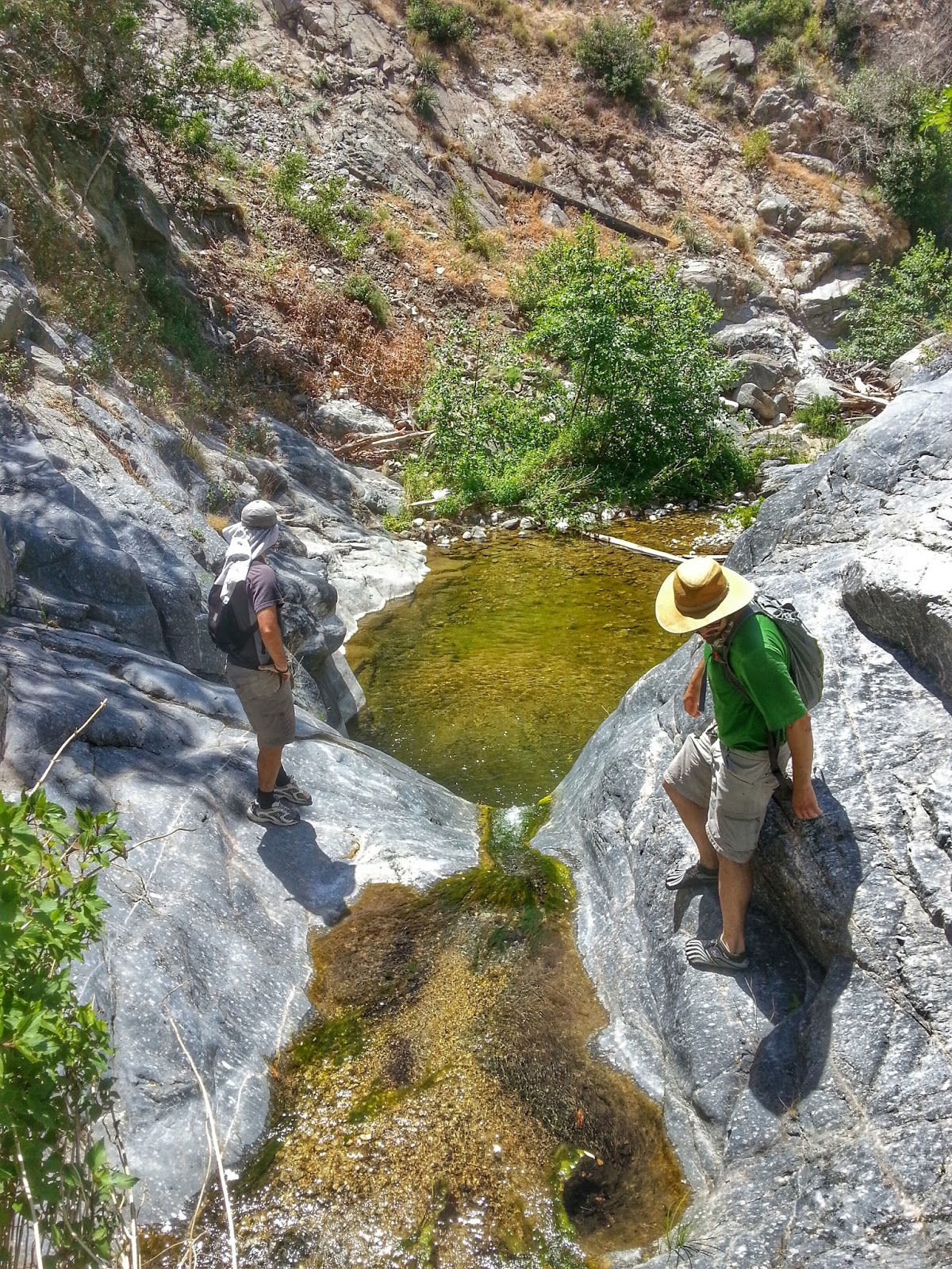
| These are deceptively dangerous. Broken ankle waiting to happen |
No need to describe much b/c the first few miles are one of the more popular trails in the Angeles. Filled with hidden history for those that hunt a bit more. We passed up seeing the waterfall and continued down towards Bear Canyon on great trail. After being tempted by several pleasant swimming holes, we came to the bend in the trail where the Arroyo Seco flows one way and the trail goes up Bear Canyon the other way.


| Carlos lower left! |
This is where we left the trail and pretty much followed the path of least resistance for the next six or seven hours. Since so much time has passed since between writing this and actually being down there the smaller details will be found best in Brennan's write up.


| Jump! |
The beginning of the canyon was much wider and allowed for easy travel with a shallow creek always near by. Many bends in the canyon passed, the going became a little slow as the vegetation grew much thicker. Walking directly in the water was best most of the time. Deeper at times, but never much over our knees. We did have to pick our way across a couple very large tree debris fields that had piled up before the canyon became too narrow.

| Collin was in the drink first |

| Carlos bombing it |
There is one waterfall in this canyon and it could be bypassed with the care on the left (looking down canyon). Even then it could end up in a plunge with a bad step. We didn't see any ropes or webbing Brennan wrote about in 1999. Now that all those details are out of the way... we just jumped off the falls into the pool below! Not advised, but was no problem with enough water in the pool.

| I slipped |


This point is still hours from the canyon's emergence into anything larger. We continued to twist and turn throughout the streambed. Jumping boulders & bothering deer. Eventually making a wide sweeping curve that showed on our map, we were getting closer to where the Arroyo meets Dark Canyon. We weren't behind schedule in anyway, but I remember it taking more time than expected to do the portion from the falls to the Oakwilde.


| Getting lower & wider in the canyon |

I can't stress enough if you are the leader on this mission keep an eye on the power lines as soon as you can see them. This will be your beacon when all else fails. It will become fairly apparent when the canyon widens up significantly and there is much more classic chaparral with oaks as apposed to the Alders and vegetation that had been filling the creeks. We found not one sign of Oakwilde Campground, wandering up Dark Canyon a bit & along the huge trees that lined the two canyons.

| Beginning our climb out of the Arroyo to Hwy 2 |

| Lots of deterrents |

| Looking back on the lower portion of Royal Gorge |
Before doing this trip, dive deep in researching a forgotten trail that a few people have written about on the net that connects Hwy 2 to Dark Canyon. I can't find the details while writing this, but I advise that. Combined with that info, we knew that the base of one of the power lines also connected with the trail. Now standing way below in the Arroyo Seco we had NO chance of finding where the trail spit out into Oakwilde, which is what we needed. Next best bet was some insane bushwhacking that still reigns in my "Top 5". Full crawling, root grabbing, type 2 fun. Forward progress was decent and eventually I paused to take a photo and noticed a faded orange trail flag above me on the slope. Voila!


| Arroyo Seco left side |
I can attest that there is the faintest of trails though. Rounding the base of the now up close mega huge power line we took a use trail back to a narrow section of Hwy 2. Walking north about five minutes on the highway we finally arrived at our second car. But wait for it... the key we needed was then discovered to be in the other car at the trailhead! The adventure continues. A nice air purification specialist picked us up and dropped us back at the top of Switzer's.