| Asia looking into Prairie Fork |
Several great things happen when you travel in the mountains for many days in a row. You get to hear packs of coyote yell at one another in your camp, high canyon walls surround you while drinking cool river water, the Milky Way Galaxy reveals itself to you in a stunning wide stripe across the night sky & you grow closer to yourself & the ones that have labored alongside you for these natural wonders. Each one of these things happened on our trip that forever imprinted the exact reasons to journey to such places.

Myself & Asia both had quite a bit of time off at the moment & worked out a 5 day "Plan A" filled with new areas in the Gabriels we had both had never been before. Throughout the week we planned for more & more friends to come & meet us on our trip. We would be mixing car camping & backpacking on this 5 day trip.

Beginning our adventure with "Plan A" underway, driving out to the dirt road that leads to Guffy Camp. This was the first place I hadn't been yet due to it's odd access. The dirt road rides directly under the Mt. High ski lifts & is covered in snow or unmaintained the rest of the year.

| Guffy camp on the ridge at sunset |
A wonderful drive, quite sheer at times, afforded wonderful views into Praire Fork & further towards Baldy. Eventually being blocked by the locked gate at the junction to Guffy. With six sites build around a loop & one jutting off hanging over a cliff staring at Pine Mt.

| Sunrise on the PCT |
That night Asia & I shared our whole camp with only one other person that had some fun Zen tunes playing through the trees. Exploring the area some that night & enjoying our first fire in the woods. Asia light our fire with magnesium & a flint first try! Waking for sunrise the next day we wandered down the PCT & captured some images overlooking the desert to the east.

After breakfast we packed up our car camping adventure & headed for Vincent Gap to welcome our first "city-escapee" to the woods. Carlos arrived & we all got our packs in order in the parking lot below Mt. Baden Powell. Unfortunately, my DSLR camera battery died at this point in the trip & here on out I was forced to use my cell phone camera.

Alas, we weren't heading up, our goal was the less traveled Vincent Gulch Trail down into the East Fork of the San Gabriels. After the junction from the Big Horn Mine trail we were tucked away in the forest shade on a beautiful mountain trail.

| Pine Mt. with Mt. Baldy peaking over on the right |
Loosing elevation through switchbacks the bugs began to grow intense. Sweaty heavily in the mid day sun wasnt helping.

Eventually the trail hits the river bed (dry at the time), crosses over & starts to become a bit less maintained. At times along the rocks, but mostly edging along the east side of the slope above the rock bed, eroded & soft in some places, but not terrible.

| Break time while hiking down Vincent Gulch |
What seemed to be about a mile from first meeting the river bed the trail drops a significant amount in a roller coaster fashion to meet a small right hand turn "grotto, water fall area" that you must rock hop. This was an important point, being the first running water we saw it was a good sign for our backapacking mission. It also marks the point where the trail completely changes to what could be called no maintenence & a fun filled class two rock scramble above the creek.

| Asia enjoying the fruits of our labors |
With one trekking pole & a firm hold on the rocks there was no real terrible danger, but this section was slowly putting a damper on our three minds about "Plan A" still being successful for future days. For you see, there is still two more attendees that were due to arrive the next day...... in the dark.

| Looking back up from where we started on the right |
Here is where our trip got a bit more interesting, after passing the grotto, passed the eroded trail over the rock section & now dipping deep into the flowing canyon with it's walls soaring over 50ft on both sides.

| Here is some of the sketchy section after "The Grotto" |
We hung a left & followed the trail (what we would learn is a use trail) up onto a small bluff over a side canyon & a dry side river bed. Climbing over a downed tree (that had worn bark from past travelers, good sign), through a few young pine trees & emerged onto a wonderful hidden trail camp.

| Trail Camp. Didn't see anyone till we got back to the car |
What was curious about this is our original goal required us to hang a right & walk a short distance to our camp. Alas, we had last taken a left & come to three rock made fire pits some 5 minute walk up from the Vincent Gulch Trail. Albeit, we didn't intend to camp the night at this mysterious odd spot, but we couldn't help but drop our packs and call it home.

It was fairly clear that we were the first visitors this camp had had since the last year, before winter took it's hold on the high country of the Gabriels. The foliage on the ground was a thick carpet to clear for a tent alone, revealing a plethora of some of the largest insects I had seen in my life. This was going to be real solitude, it was obvious.

| This is further down the trail on another eroded section. You can barely make out a person sitting in the bottom center. They are filtering water near our use trail turn off |
This gulch's protection allowed the forest to grow large & dense, as well as the bugs to become accustomed to long, long lives. We spent the afternoon relaxing in Asia's new lightweight hammock & just sitting in nature's beautiful splendor.

| Fetching the nights water |
Now resting deep in Vincent Gulch, place number two I had never been, we needed several things to happen before the day's light was lost. First, hanging our food in a bear bag up a tree, we could leave camp safely to filter water for the nights cooking. Our watering hole was dead center among the high rock walls allowing for no possible way to have a bad time. Climbing all over the fallen trees & resting our muscles in the cold mountain water.

Last chore was to gather firewood & begin our transition from day to night. Becoming more stationary near the growing fire & the impending darkness, the mosquito's had a small feast. It was only the second day of summer & the cooler temps in the valley didn't happen till close to 9pm to scare the little buggers off.

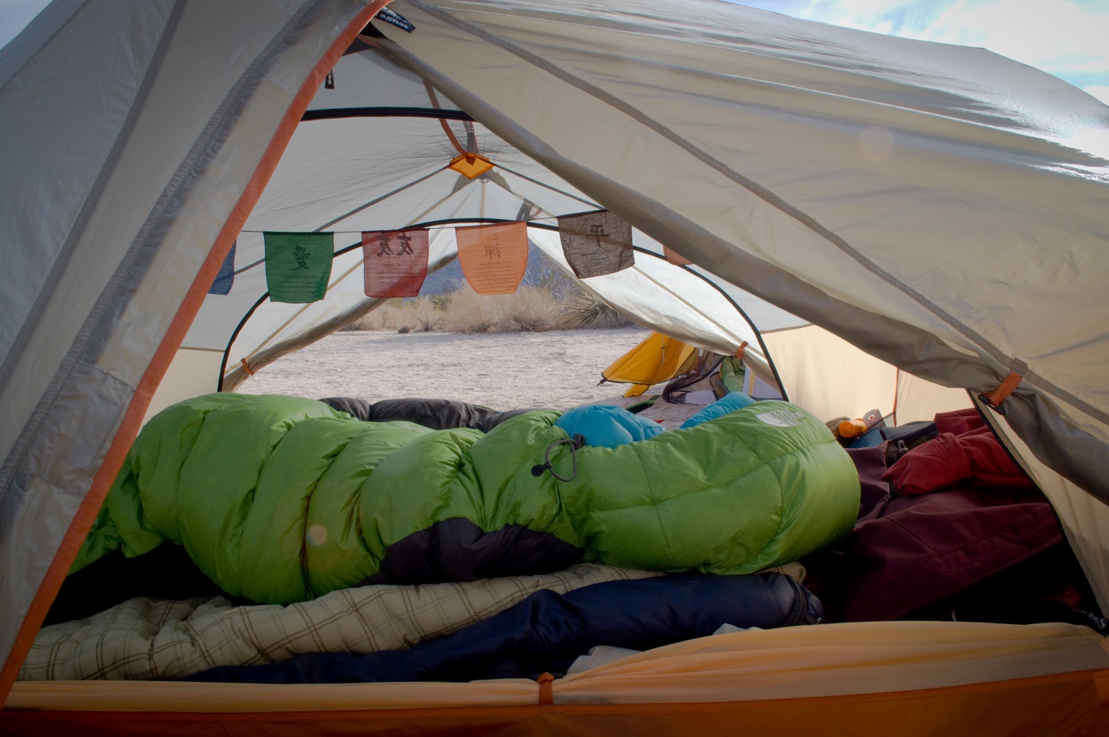
| Still in love with my Big Agnes UL 3 person |
A peaceful slumber & a late morning in the outdoor sense, the three of us convened to decide the trips fate. Should we move on to "Plan B"? The three of use were going to hike back up to the parking lot, meet Georgette & Collin around 9:30pm, then assist them to backpack in the dark back to our camp. This was one of those plans made while looking at a black dotted line on a map in the backyard weeks before.

Agreeing that with more confidence, it was quite possible to achieve this night hike, but with too many stories in the back of our minds that confidence & a few miscalculated moves can lead to bad situations.

| Becoming more wild in the canyon of Vincent Gulch |
Getting our packs in order we set out for "Plan B", back up Vincent Gulch with enough time to call our friends & opt for a change to Horse Flats to end out our camping weekend.

| Sweating our butts off |
Let my not get ahead though, the three of us were still in the far reaches of Vincent Gulch, just heading out into what would become a fog of tiny flies within the first minutes of the trail. Until we reaches the lower switch back some 2 miles up hill, we sweated, blistered, swatted & cursed the 30+ that swarmed each one of us. I opted at times to stand in the open hot sections of the trail & rest just to escape areas the flies wouldn't go.

Quite deceiving (as I would read later), the hike out of Vincent Gulch is very strenuous under 30lbs of weight. Others on the blog-o-sphere would attest to the same thing, so be fore warned. What kept us going was the thought of that cooler in the back of the car with cold drinks.

| Looking down into Prairie Fork from outside Guffy |
Much rest & refreshments later, we found ourselves pulling into Horse Flats past the several camps that dot it's entrance. That evening the three of us collected firewood, relaxed in the hammock, & prepared for two more friends to arrive.

| Mt. Hillyer Trail |
That evening around 9:30pm, Collin and Georgette arrived & our group was complete. They had the biggest smiles on their face, after working all day on a Friday, they were now escapee's in the woods.

| Life is good. Mt. Hillyer Trail |
The next day we took the usual trail up to Mt. Hillyer, taking time to climb on all the necessary rock boulders. This is a very unique trail that contours through huge boulder fields & young kids with crash pads line the endless off trail exploring options.

| Horse Flats Campground |
It was thoroughly enjoyable to be on the summit of Hillyer for the third time. Not particularly impressive, but it was after 4 days of enjoying very different areas of the Gabriels; Guffy & the high alpine terrain, then the deep river gorge of Vincent Gulch & now amongst the house size boulders of Mt. Hillyer. All the while, adding new dynamics to the group with wonderful friends to share each day with.

Closing on day four we lost Asia to the city. Gathering wood once again, we set in for a comfortable night of chatting around the fire. I know I've said interesting things happened on this trip, but our last night's events took the cake for unexpected. While tucking into the my tent for the night, literally half in half out, Collin calls out that he hears a girl calling my name softly off in the distance, but growing closer. My girlfriend was sitting right in front of me in her sleeping bag so I had no idea who else knew my name out here. Standing up, in our now dark camp, a girl in her early 20's walks out of the blackness, with no acknowledgement to me or the 2 foot distance between us, keeps walking past as I ask if everything is ok, a bit startled. Not a single word came out of her mouth or even a head turn. She walked on out of our camp, hearing the bushes rustle I was a bit in shock. Did that just happen? It was like everything was invisible and she didnt see anything or anyone. I turned to get back in my tent & I heard the bushes rustle some more. Coming back is the same girl now & I address her a bit more aggressively & she very drunkenly admits she is lost. Fortunately, it was someone I had seen in there camp before while strolling so I helped her to the road & told her to just follow the asphalt sound & stay on the road, her camp was the next one over. Well, ten steps later she was off the road, heading in the woods away from the entire campground in a drunken stooper. Now realizing how serious she needed help, I took her arm & walked with head lamp back to her camp. A bit on edge I might be walking into some sort of ambush (after all we are outside LA). Speaking with her I found out her camping partner was also named Jeremy & the puzzle pieces began to fall into place. She eventually recognized the car & her camp was all pitch black, there was no chance for her to go pee, while drunk & find her way back w/o a flashlight. Dropping her off w/o entering the camp for my safety, I checked over my shoulder on the way back to my tent. She literally would have walked off in a western direction out of the campground into the woods if she hadn't crossed our path, the only & last people she would have seen. Fortunately, I wasn't in my sleeping back either. To think...

Let's get back to the fun, opening on day five (for myself at least) we sat around the fire & packed up slowly. Only thinking of what amazing food establishment to first bombard with our disgusting smell. The Blue Dog Tavern was the culprit & garlic fries w/ beers only added to the wonderful stench.