Monday, June 20

Art In The Streets - MOCA

|CLICK ANY PHOTO TO ENLARGE, CAMERA PHONE IMAGES |


Finally made it down to MOCA's latest Art in the Streets exhibit. Just a heads up, Mondays are free until the exhibit goes away courtesy of Banksy.


With a great flow, beginning with information dating back to the turn of the century train yard workers all they way up to present times.


When I first walked in I was overwhelmed by how huge the space was. Expecting a few walls & a more information than pieces.


From all areas & all walks of life. The most crowded section was the Banksy area. Two of the many pieces below.


One of my favorites of the exhibit was getting to see the original design of the famous Sex Pistols cover for the album God Save the Queen.


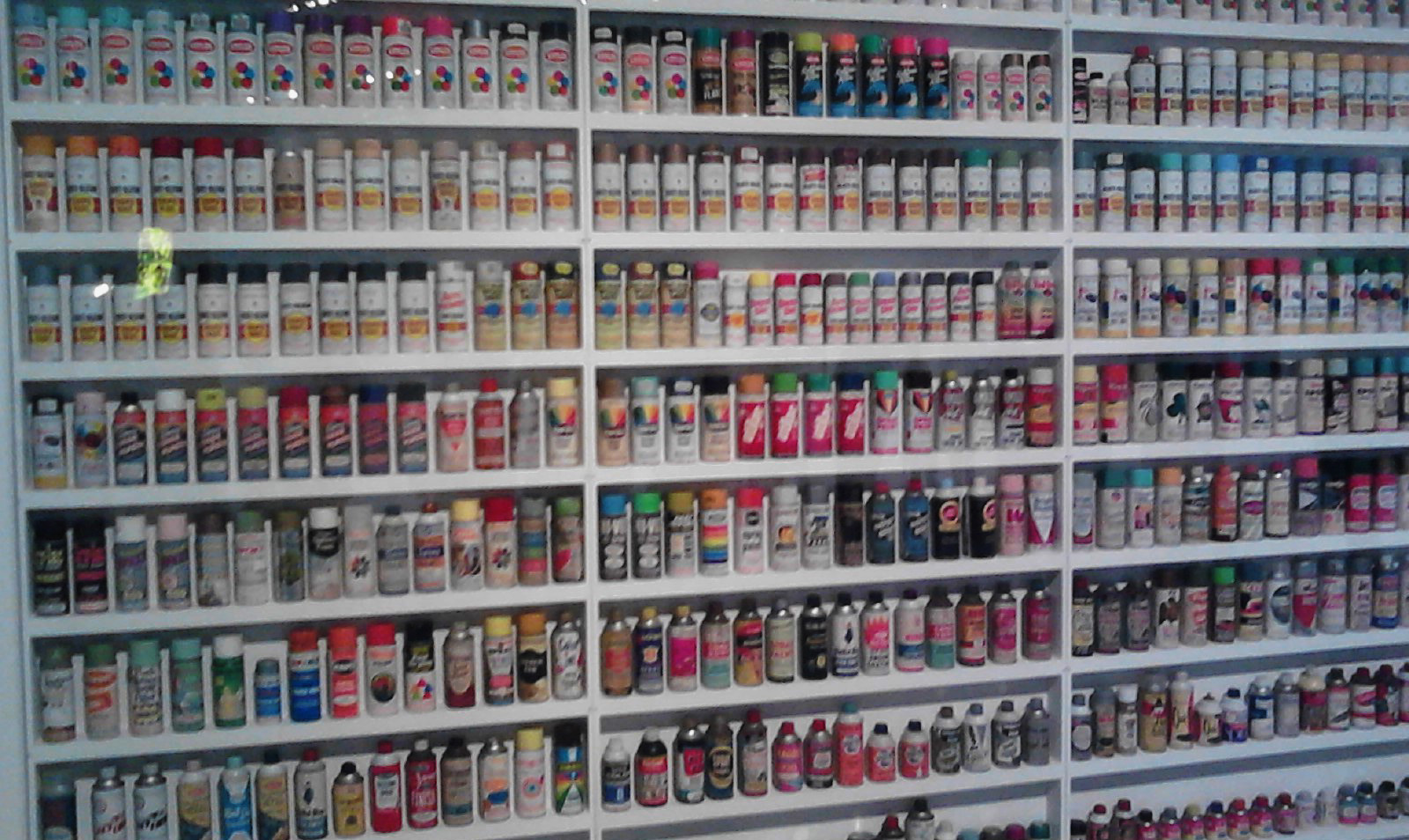
History of the spray paint can. Fabulous wall display.


Really loved the colors on this 80's SF based artist.


Lastly, the always provocative... Ed Templeton Photo Wall


Saturday, June 18

Horse Flats - A Second Journey

|CLICK ANY PHOTO TO ENLARGE |


After only four days back in Los Angeles, after Georgette & I's frozen over night adventure... Here I was. Circling Horse Flats Campground again with Carlos Flores this time.


With such a close proximity to LA, any drive up Angeles Crest Highway is going to be a great time out of the city. With any number of hikes that will take you to peaks over 6,000ft or to hidden valley waterfalls.


Carlos & I took a similar route as previous & were thrown into a whole new experience.


Hollyer Peak - Angeles National Forest


Station Fire 2008 burned large portion of the Angeles Nation Forest. While crucial to a forest natural growth, it leaves an interesting trail in its path.


With another great hike behind us, grilled pineapple cheese hamburgers in our stomachs & the fire at our feet, we set in for the night.


All throughout the night Mother Nature tested us in a completely different way than just four days prior. Hours before bed the clouds blew into our campground at 5,600ft & proceeded to cover us with 'heavy moister to light rain' all night. Waking to a beautiful morning, but a chore ahead of us.


Horse Flats Camping - First Days of Summer

|CLICK ANY PHOTO ENLARGE|
After the adventure Georgette & I had in Big Sur, we decided to try for a one night camping trip into the hills outside Los Angeles.


With a loose plan of traversing Angeles Crest Highway & stopping in at several campgrounds to see what options we had as far as availability. Hwy 2, recently reopened after 2008's Station Fire, wanders through Angeles National Forest to absolute solitude from any semblance of city life.


Eventually deciding on Horse Flats Campground, which is at the mid point of a nice 5 mile one lane paved road winding off Hwy2, helping to get us out into the wilderness more so than before. Setting up camp to a totally empty surrounds was unreal. We had no neighbors & no people, the entire time Georgette & I were camping, hiking or exploring. Total seclusion.


After a great afternoon hike to Hollyer Peak (spelling?), we build a fire & kept warm to the best of our ability. This adventure brought a bit different type of cold in our direction than previously in Big Sur. This was an alpine cold, sleeping at 5,600 feet, waking to crunchy frost covered meadows & a fine layer of snow/ice on everything.


Alas, this was indeed a new & great adventure with a determined co-pilot all throughout the journey.

Only four days later I found myself setting up camp at the same place with a different adventure. NEW POST SOON.


View Larger Map

Tuesday, June 7

Big Sur Camping - California's Coastal Splendor

|CLICK ANY PHOTO TO ENLARGE|


For many years I have heard the rumors of a small region of the central California coast, that boasts beautiful countryside like no other. In fact, I came to learn there are only three places in the world you can see such wonders, two of which are in California & the other in China.


Old Coast Rd.
Alas, the region of Big Sur, perched along California's famous highway 1, is the only area were such unique forest landscape collides with the dramatic Pacific coast line. The natural landscape is split into several different state parks that make of the Big Sur region along the coast.


Like I had said before, after so much talk in the past, it was time to make the journey. With my faithful co-pilot Georgette by my side we made the five & half hour drive from LA, up HWY101, over the Naciemento-Ferguson detour (which was most spectacular, no qualms there), dropping us down on HWY 1 just south of Lucia.


HWY 1
For the first time camper in the group, we opted for a more substantial shelter & reserved a half tent/half wood cabin for our stay. Only a bed & a small table inside though, can't be too nice. To get back to the natural camping state we did make campfire meals & endure the general chill of the night.


Big Sur State Park
On the first day we managed to traverse what turned out to be one of the most unique adventures we have ever had together. I had researched some scenic roads that lead through the back country & found that the Old Coast Rd. is one not to miss, say the insiders. They were sure right!! This 12 mile stretch of dirt road was the most beautiful, scenic, secluded, romp we could have asked for.


Old Coast Rd.
Taking us through the valleys & tall redwood forest, then back up to mountain peaks looking over the Pacific Ocean to one side & lush green forest valley to the other.


HWY 1
After a chilly first night, we woke early with the intention of completing 3 different hikes... and it happened! The first was a mild trip out to McWay Falls. A beautiful cliff side waterfall right off the side of the highway.


McWay Falls
Helpful hints! You can buy a $10 day pass to one park & use it for any one of the many parks along the coast, we went to three. At McWay Falls we were some of the first visitors in the park at 8am & we had it all to ourselves. Later in the day you can see cars spilling out onto the HWY trying to park here. Photo lover beware, sunsets are better due to morning shadows.


Click to Enlarge: You can see McWay Falls on the left falling into the ocean
We then moved on the hike number two, Pfeiffer Falls. A little strenuous mile and half hike in to a great double waterfall. We saw quite a few people on this hike due to it's shorter length. The falls a were a nice sheet of falling water, sliding down a sloped rock face.


Andrew Molera State Park
After a lunch & pit stop, we moved on to our long hike of the day to the beach. This hike proved to be one of the most challenging. After a couple conversations with people about how beautiful the destination is, most fail to mention the 25 foot river crossing with no dry route.


Andrew Molera State Park
Once passed this, the hike will took us through huge grassy fields with more bird songs in the air than one could count. The view all around is of the rolling hills & the forest meeting the flat bluffed coast. At the shore we sat & enjoyed the view, plus the howling offshore wind for the surfers, but no one was out.


Andrew Molera State Park
We made our way from the sand up along the bluff above the ocean for more than forty five minutes. We stopped, picked a good scenic place to sit & enjoyed mother nature's splendor.


Andrew Molera State Park
On our last day we packed up our site, said good-bye to the two blue jays that hounded our campsite & headed out early. I stopped along the HWY for a couple last photos & a quick trip around another campground for ideas of another visit.


HWY 1
Georgette & I were up for one more hike before we had to site in the car all day so we planned to stop & do the Mill Creek Trail that was right at the head of the Naciemento-Ferguson road. This trail on the south end of the park proved to me a bit less maintained, to say the least. About a mile in it was decided we should enjoy the view around, but make our way slowly back to the car.


Mill Creek Trail

"You don't take a photograph, you make it."
-Ansel Adams

Monday, May 30

Bob Marley Exhibit & More @ Grammy Museum


ABOVE: The house Robert Marley was born & given by his grandmother on Nine Mile St.

Let me start off by saying how much I love LA. There are enough interesting things to see & do for a lifetime and then some in this great city. This post is about the Grammy Museum & how reggae's biggest start has impacted the music world. Keep in mind, there was supposed to to be no photography in the museum. These are all camera phone photos.


There was one point where I liked reggae music, then there was a point that came when I wanted to know ABOUT reggae music. I have spent the last couple years reading, listening & searching out the roots & history of the Caribbean & Jamaican music both folk & tradition reggae.


ABOVE
LEFT: "Judge Not" Robert Marley's first studio release (1963)
RIGHT: "Simmer Down" first pressing - The Wailers (1964)

Along with over twenty amazing photos, the Marley family has donated many many great artifacts from the legacy of Robert Marley's musical career. I felt this was an exhibit that would only help further my knowledge of one of reggae's most prominent figures... w/ neat tid-bits we might not always get to see in the public sphere.


ABOVE: The Kebra Nagast - The Lost Bible of Rastafarian Wisdom & Faith from Ethiopia & Jamaica

Much of the backdrop for reggae music is driven by religious & cultural views of the artist. While this is most commonly Rastafarian, there are many different sects w/ that one belief structure that all have different takes on their religion, just as any other culture. When these seep into the lyrics & morals of the songs presented.


(one of many walls)

The Grammy Museum is four floors of amazing interactive history about all different types of popular music history. One floor is dedicated to the last hundred years & also has a wonderful exhibit all about John Lennon. There are many hand written lyrics pieces & letters.


ABOVE: The originally penned lyrics for John Lennon's song Imagine

One of my other favorite portions was the area all about the history of American Jazz. Without going into too much detail, Jazz music history is another area that weaves roots so deep that must be explored over the coming years as well. However, it almost never fails, I find a Jazz artist I like & while looking into their discography I find links & traces to Blue Note Records somewhere.


ABOVE: The first release by Blue Note Records ever.


ABOVE: Daft Punk outfits from Kanye West's music video 'Stronger'


ABOVE
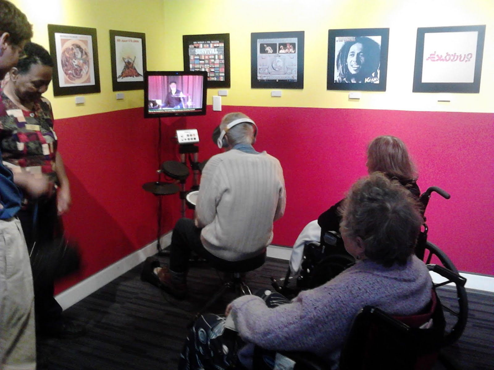
While walking through the entire museum there was a senior group that we talked with a few times & were really enjoying themselves. This older gentleman got down & played some electric drums reggae style. It was great!

Monday, May 16

Secret Stairs - Mother's Day!


Another great Secret Stairs adventure with the people that set in motion the pursuit of urban elevation exploration... my parents.


After receiving the book as a Christmas gift, friends & loved ones alike, have all been on one journey or another through a hidden Los Angeles neighborhood; enriched by the knowledge & history the author brings forth.


This past Mother's Day, after lunch at Bella's, we made our way south on the 110 to the Highland Park area. The first half of our walk was through the foothill neighborhoods that lined the arroyo seco area.


We learned a great deal about a long forgotten piece of Los Angeles history, the Great California Cycle Way (must see!)


Forging back over the river and up a flight of stairs that took us back into the quiet neighborhoods & further into the south eastern hills of Highland Park.


A new adventure in a part of town I had only been a few times. From back alley graffiti to San Gabriel Mountain views, this secret stairs really encompassed it all.


Thanks again Mom for turning me on to great new adventures!


Sunday, May 15

West Fork Bith Path - Hidden LA Gem

I'm going to come right out and say it... I went on the best bike ride I have ever been on this past weekend.


The West Fork Bike Path combines everything one could love about the mountains, hiking, rivers, waterfalls & puts them on a bicycle path through the canyons outside Azusa, California.


After a winding drive up Hwy 39, past two resivors, you will find yourself deep in the what I believe is call the San Gabriel Canyon. A ranger station meets you as you pass the second resivor & visitors must purchase a $5 day pass or opt for the risk of towing or ticketing.


The path begins at a bridge crossing & follows the river for 8 mile w/ a class 1 path. Slowly taking the rider past several small waterfalls, many people 'catch & release' fishing, along with a few families splashing around in the water.


The whole experience left me with a need for more adventure. Another ride will soon be taken through the canyon... who's coming next time?